Wyandotte night lights from space
Night Light of Wyandotte (Michigan) from space (United States) Src. Average luminocity for 10x10km area is 75.7394% and for 50x50km: 56.8094%.
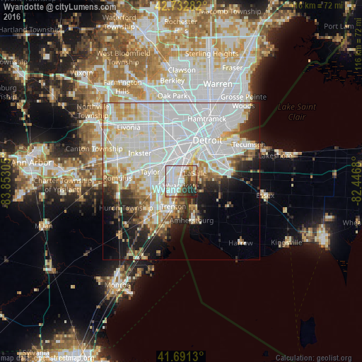
Analysis of Wyandotte night lights 2016
Square area 10x10 km:
 25.45%
90-99
28.18%80-89
3.79%70-79
6.21%60-69
4.85%50-59
5.76%40-49
7.42%30-39
9.55%20-29
7.42%10-19
1.36%0-9
0%Square area 50x50 km:
24.61%90-99
15.25%80-89
5.18%70-79
4.93%60-69
3.51%50-59
3.11%40-49
2.91%30-39
3.14%20-29
5.68%10-19
8.16%0-9
23.52%Clear (daylight) street map image can be seen on geolist.org.
Map coordinates:
42° 43' 58.2" North, 83° 51' 11" West
42° 12' 51.2" North, 83° 8' 59.7" West
41° 41' 28.7" North, 82° 26' 48.5" West
Some cities around Wyandotte sort by population:
• Lincoln Park
4.7 km =2.9 mi,  329°
329°
• Southgate
3.6 km =2.2 mi,  269°
269°
• Allen Park
7 km =4.3 mi,  313°
313°
• Trenton
8.6 km =5.3 mi,  195°
195°
• Riverview
5.1 km =3.2 mi,  208°
208°
• Melvindale
7.9 km =4.9 mi,  344°
344°
• Ecorse
3.4 km =2.1 mi,  5°
5°
• River Rouge
6.7 km =4.2 mi, 11°
5015599 (p: 25,156)
Sources (retrieved 2019-11-25):
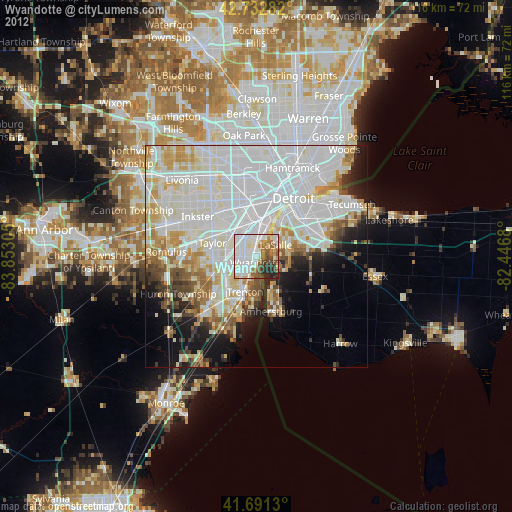
» Earth at Night: Flat Maps 2012, 2016