Taos night lights from space
Night Light of Taos (New Mexico) from space (United States) Src. Average luminocity for 10x10km area is 23.3304% and for 50x50km: 1.2457%.
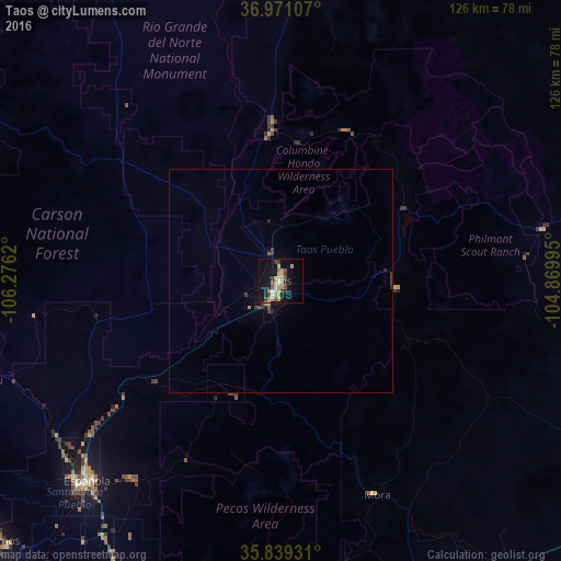
Analysis of Taos night lights 2016
Square area 10x10 km:
 1.57%
1.57%90-99
2.1%80-89
1.4%70-79
8.57%60-69
4.02%50-59
1.57%40-49
3.32%30-39
5.07%20-29
1.4%10-19
20.8%0-9
50.17%Square area 50x50 km:
0.06%90-99
0.08%80-89
0.06%70-79
0.35%60-69
0.2%50-59
0.09%40-49
0.2%30-39
0.4%20-29
0.17%10-19
0.93%0-9
97.46%Clear (daylight) street map image can be seen on geolist.org.
Map coordinates:
36° 58' 15.9" North, 106° 16' 34.3" West
36° 24' 26.1" North, 105° 34' 23.1" West
35° 50' 21.5" North, 104° 52' 11.8" West
Some cities around Taos sort by population:
• Santa Fe
86.5 km =53.7 mi,  202°
202°
• Las Vegas
95.7 km =59.5 mi,  160°
160°
• Los Alamos
87.6 km =54.4 mi,  228°
228°
• Española
64.9 km =40.3 mi,  224°
224°
• Alamosa
121 km =75.2 mi,  347°
347°
• Raton
115.2 km =71.6 mi,  61°
61°
• Eldorado at Santa Fe
103.2 km =64.1 mi, 198°
• White Rock
85.8 km =53.3 mi, 221°
5493811 (p: 5,740)
Sources (retrieved 2019-11-25):
» Earth at Night: Flat Maps 2012, 2016