Santa Fe night lights from space
Night Light of Santa Fe (New Mexico) from space (United States) Src. Average luminocity for 10x10km area is 48.715% and for 50x50km: 5.7229%.
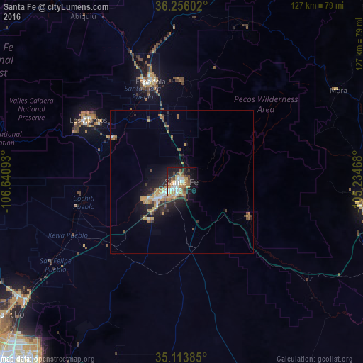
Analysis of Santa Fe night lights 2016
Square area 10x10 km:
 7.87%
7.87%90-99
10.14%80-89
5.42%70-79
10.49%60-69
9.27%50-59
4.55%40-49
5.42%30-39
4.72%20-29
8.92%10-19
24.65%0-9
8.57%Square area 50x50 km:
0.55%90-99
0.7%80-89
0.53%70-79
1.33%60-69
1.2%50-59
0.51%40-49
0.61%30-39
0.86%20-29
1.86%10-19
3.73%0-9
88.11%Clear (daylight) street map image can be seen on geolist.org.
Map coordinates:
36° 15' 21.7" North, 106° 38' 27.3" West
35° 41' 13.1" North, 105° 56' 16.1" West
35° 6' 49.9" North, 105° 14' 4.8" West
Some cities around Santa Fe sort by population:
• Enchanted Hills
70.9 km =44.1 mi,  236°
236°
• Las Vegas
65.3 km =40.6 mi,  99°
99°
• Los Alamos
40.1 km =24.9 mi,  303°
303°
• Española
36.2 km =22.5 mi,  339°
339°
• Bernalillo
70.2 km =43.6 mi,  232°
232°
• Corrales
78.5 km =48.8 mi, 230°
• Eldorado at Santa Fe
17.9 km =11.1 mi,  179°
179°
• White Rock
28.6 km =17.8 mi, 303°
5490263 (p: 84,099)
Sources (retrieved 2019-11-25):
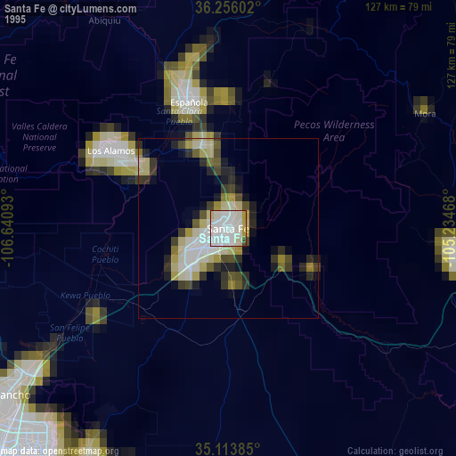
» NASA, Earths city lights 1995
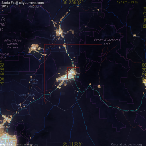
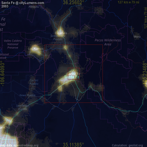
» NASA city lights 2003
» Earth at Night: Flat Maps 2012, 2016