White Rock night lights from space
Night Light of White Rock (New Mexico) from space (United States) Src. Average luminocity for 10x10km area is 7.4668% and for 50x50km: 7.9244%.
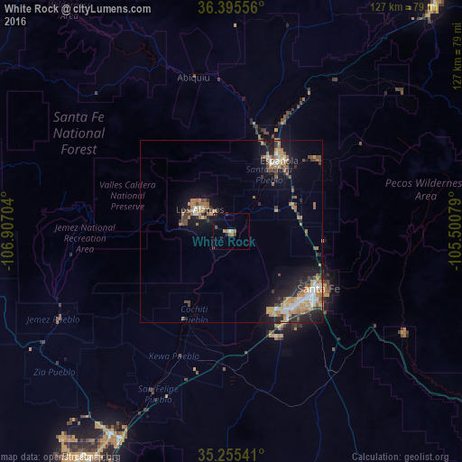
Analysis of White Rock night lights 2016
Square area 10x10 km:
 0.52%
0.52%90-99
0.52%80-89
0%70-79
1.4%60-69
2.8%50-59
0%40-49
1.05%30-39
2.1%20-29
1.4%10-19
1.75%0-9
88.46%Square area 50x50 km:
0.78%90-99
0.98%80-89
0.66%70-79
1.74%60-69
1.78%50-59
0.72%40-49
1.03%30-39
1.2%20-29
1.88%10-19
5.49%0-9
83.73%Clear (daylight) street map image can be seen on geolist.org.
Map coordinates:
36° 23' 44" North, 106° 54' 25.3" West
35° 49' 39.1" North, 106° 12' 14.1" West
35° 15' 19.5" North, 105° 30' 2.8" West
Some cities around White Rock sort by population:
• Rio Rancho
78.1 km =48.5 mi,  212°
212°
• Enchanted Hills
64.9 km =40.3 mi, 212°
• Santa Fe
28.6 km =17.8 mi,  123°
123°
• Los Alamos
11.5 km =7.1 mi,  305°
305°
• Española
21.3 km =13.2 mi,  31°
31°
• Bernalillo
66.5 km =41.3 mi, 208°
• Corrales
75 km =46.6 mi, 209°
• Eldorado at Santa Fe
41.4 km =25.7 mi,  144°
144°
5497876 (p: 5,725)
Sources (retrieved 2019-11-25):
» Earth at Night: Flat Maps 2012, 2016