Fountainebleau night lights from space
Night Light of Fountainebleau (Florida) from space (United States) Src. Average luminocity for 10x10km area is 99.5758% and for 50x50km: 57.747%.
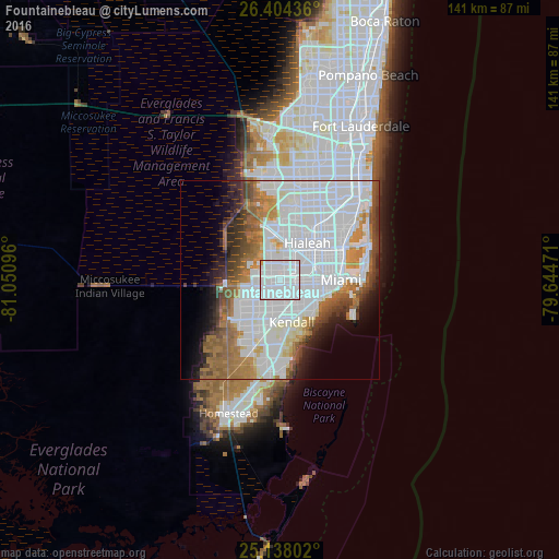
Analysis of Fountainebleau night lights 2016
Square area 10x10 km:
 87.69%
90-99
11.17%80-89
0%70-79
1.14%60-69
0%50-59
0%40-49
0%30-39
0%20-29
0%10-19
0%0-9
0%Square area 50x50 km:
30.12%90-99
10.56%80-89
2.35%70-79
3.25%60-69
7.7%50-59
4.72%40-49
4.58%30-39
3.67%20-29
3.99%10-19
5.19%0-9
23.87%Clear (daylight) street map image can be seen on geolist.org.
Map coordinates:
26° 24' 15.7" North, 81° 3' 3.5" West
25° 46' 22.4" North, 80° 20' 52.2" West
25° 8' 16.9" North, 79° 38' 41" West
Some cities around Fountainebleau sort by population:
• Doral
5.2 km =3.2 mi,  351°
351°
• Flagami
3.4 km =2.1 mi,  110°
110°
• Westchester
2.9 km =1.8 mi,  134°
134°
• University Park
3.5 km =2.2 mi,  213°
213°
• Coral Terrace
5.3 km =3.3 mi,  124°
124°
• Sweetwater
2.7 km =1.7 mi,  247°
247°
• Olympia Heights
5.2 km =3.2 mi,  188°
188°
• West Miami
5.3 km =3.3 mi,  101°
101°
4156091 (p: 59,764)
Sources (retrieved 2019-11-25):
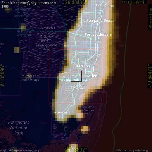
» NASA, Earths city lights 1995
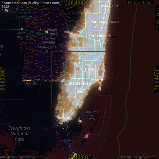
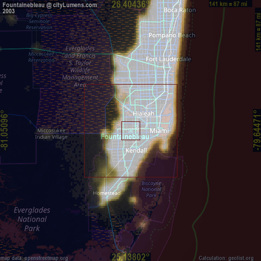
» NASA city lights 2003
» Earth at Night: Flat Maps 2012, 2016