Tacoma night lights from space
Night Light of Tacoma (Washington) from space (United States) Src. Average luminocity for 10x10km area is 89.9137% and for 50x50km: 39.8076%.
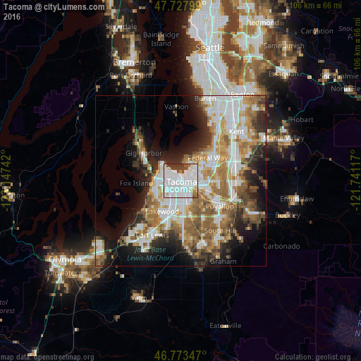
Analysis of Tacoma night lights 2016
Square area 10x10 km:
 57.59%
90-99
20.98%80-89
3.72%70-79
2.23%60-69
2.08%50-59
3.13%40-49
5.21%30-39
5.06%20-29
0%10-19
0%0-9
0%Square area 50x50 km:
9.88%90-99
8.54%80-89
3.44%70-79
5.34%60-69
6.62%50-59
6.53%40-49
4.19%30-39
4.03%20-29
6.71%10-19
10.05%0-9
34.67%Clear (daylight) street map image can be seen on geolist.org.
Map coordinates:
47° 43' 40.8" North, 123° 8' 50.7" West
47° 15' 10.4" North, 122° 26' 39.4" West
46° 46' 24.5" North, 121° 44' 28.2" West
Some cities around Tacoma sort by population:
• Lakewood
10.6 km =6.6 mi,  211°
211°
• University Place
8.2 km =5.1 mi,  256°
256°
• Fife
6.8 km =4.2 mi,  102°
102°
• Midland
10 km =6.2 mi,  162°
162°
• Waller
8.1 km =5 mi,  135°
135°
• Milton
9.9 km =6.2 mi,  93°
93°
• Fircrest
5.6 km =3.5 mi,  254°
254°
• Wollochet
10.7 km =6.6 mi,  279°
279°
5812944 (p: 207,948)
Sources (retrieved 2019-11-25):
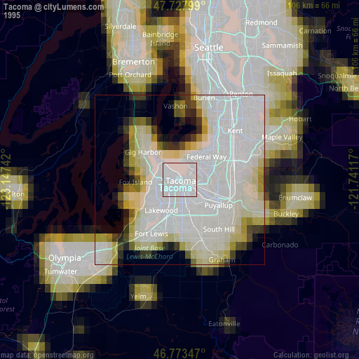
» NASA, Earths city lights 1995
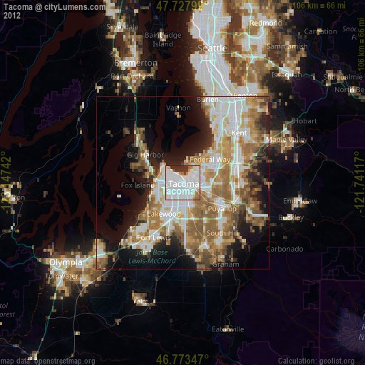
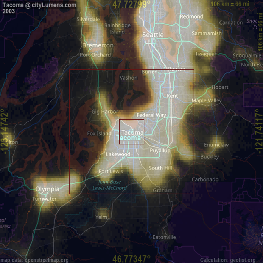
» NASA city lights 2003
» Earth at Night: Flat Maps 2012, 2016