Sylacauga night lights from space
Night Light of Sylacauga (Alabama) from space (United States) Src. Average luminocity for 10x10km area is 48.243% and for 50x50km: 6.7088%.
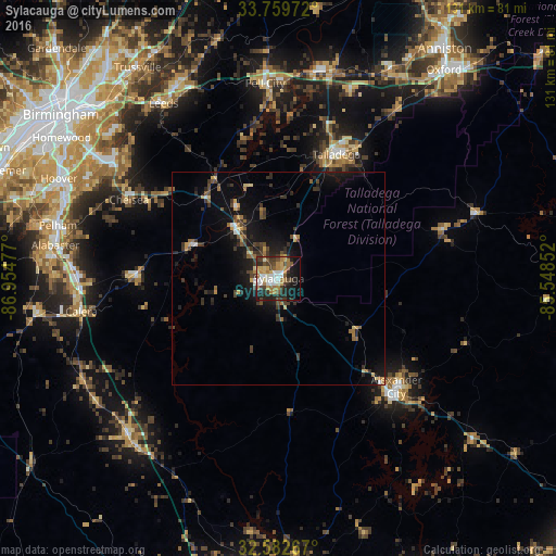
Analysis of Sylacauga night lights 2016
Square area 10x10 km:
 8.39%
8.39%90-99
7.69%80-89
5.07%70-79
8.22%60-69
10.14%50-59
4.37%40-49
7.87%30-39
9.09%20-29
13.64%10-19
19.93%0-9
5.59%Square area 50x50 km:
0.51%90-99
0.48%80-89
0.78%70-79
0.75%60-69
1.03%50-59
0.74%40-49
1.21%30-39
1.97%20-29
1.92%10-19
5.99%0-9
84.6%Clear (daylight) street map image can be seen on geolist.org.
Map coordinates:
33° 45' 35" North, 86° 57' 17.2" West
33° 10' 23.4" North, 86° 15' 5.9" West
32° 34' 57.6" North, 85° 32' 54.7" West
Some cities around Sylacauga sort by population:
• Talladega
32.2 km =20 mi,  24°
24°
• Alexander City
37.7 km =23.4 mi,  132°
132°
• Pell City
46 km =28.6 mi,  356°
356°
• Calera
47.4 km =29.5 mi,  260°
260°
• Chelsea
39.8 km =24.7 mi,  297°
297°
• Meadowbrook
48.6 km =30.2 mi, 301°
• Brook Highland
48.9 km =30.4 mi,  306°
306°
• Childersburg
15.1 km =9.4 mi,  320°
320°
4092671 (p: 12,657)
Sources (retrieved 2019-11-25):
» Earth at Night: Flat Maps 2012, 2016