Pell City night lights from space
Night Light of Pell City (Alabama) from space (United States) Src. Average luminocity for 10x10km area is 42.6081% and for 50x50km: 15.5137%.
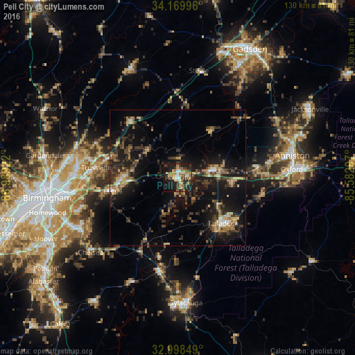
Analysis of Pell City night lights 2016
Square area 10x10 km:
 3.11%
3.11%90-99
5.49%80-89
7.51%70-79
8.42%60-69
6.96%50-59
7.69%40-49
4.95%30-39
8.79%20-29
13.74%10-19
28.57%0-9
4.76%Square area 50x50 km:
0.7%90-99
0.91%80-89
2.22%70-79
2.15%60-69
2.1%50-59
1.97%40-49
2.85%30-39
5.32%20-29
5.33%10-19
15.63%0-9
60.81%Clear (daylight) street map image can be seen on geolist.org.
Map coordinates:
34° 10' 11.9" North, 86° 59' 21.2" West
33° 35' 10.4" North, 86° 17' 9.9" West
32° 59' 54.6" North, 85° 34' 58.7" West
Some cities around Pell City sort by population:
• Trussville
30.1 km =18.7 mi,  277°
277°
• Talladega
23.6 km =14.7 mi,  134°
134°
• Moody
19 km =11.8 mi,  271°
271°
• Leeds
24.3 km =15.1 mi,  259°
259°
• Clay
31.8 km =19.8 mi,  294°
294°
• Lincoln
15.8 km =9.8 mi,  79°
79°
• Grayson Valley
33.4 km =20.8 mi, 281°
• Childersburg
34.8 km =21.6 mi,  190°
190°
4082589 (p: 13,646)
Sources (retrieved 2019-11-25):
» Earth at Night: Flat Maps 2012, 2016