Sweetwater night lights from space
Night Light of Sweetwater (Texas) from space (United States) Src. Average luminocity for 10x10km area is 29.0256% and for 50x50km: 1.6942%.
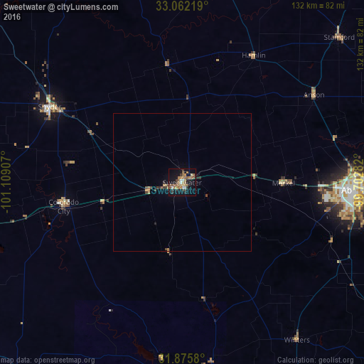
Analysis of Sweetwater night lights 2016
Square area 10x10 km:
 2.01%
2.01%90-99
2.38%80-89
1.1%70-79
6.59%60-69
9.34%50-59
7.51%40-49
1.47%30-39
5.49%20-29
1.47%10-19
33.15%0-9
29.49%Square area 50x50 km:
0.08%90-99
0.09%80-89
0.11%70-79
0.37%60-69
0.42%50-59
0.33%40-49
0.24%30-39
0.34%20-29
0.15%10-19
1.38%0-9
96.48%Clear (daylight) street map image can be seen on geolist.org.
Map coordinates:
33° 3' 43.9" North, 101° 6' 32.7" West
32° 28' 15.4" North, 100° 24' 21.4" West
31° 52' 32.9" North, 99° 42' 10.2" West
Some cities around Sweetwater sort by population:
• Abilene
63.2 km =39.3 mi,  92°
92°
• San Angelo
112 km =69.6 mi,  181°
181°
• Big Spring
103.7 km =64.4 mi,  256°
256°
• Snyder
55.2 km =34.3 mi,  299°
299°
• Lamesa
147.7 km =91.8 mi,  281°
281°
• Slaton
157.7 km =98 mi,  312°
312°
• Breckenridge
144.3 km =89.7 mi,  77°
77°
• Post
121.2 km =75.3 mi, 311°
5531968 (p: 10,809)
Sources (retrieved 2019-11-25):
» Earth at Night: Flat Maps 2012, 2016