Rowlett night lights from space
Night Light of Rowlett (Texas) from space (United States) Src. Average luminocity for 10x10km area is 77.7198% and for 50x50km: 66.7074%.
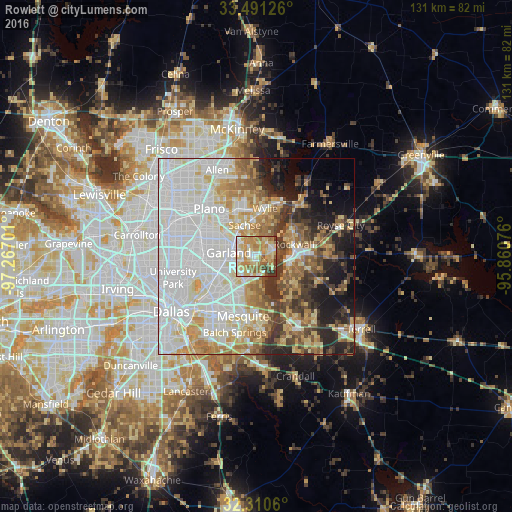
Analysis of Rowlett night lights 2016
Square area 10x10 km:
 10.99%
90-99
16.67%80-89
22.34%70-79
20.51%60-69
17.77%50-59
4.58%40-49
2.56%30-39
4.58%20-29
0%10-19
0%0-9
0%Square area 50x50 km:
22.35%90-99
16.92%80-89
8.88%70-79
7.39%60-69
7.7%50-59
5.68%40-49
4.23%30-39
6.68%20-29
5.52%10-19
7.68%0-9
6.97%Clear (daylight) street map image can be seen on geolist.org.
Map coordinates:
33° 29' 28.5" North, 97° 16' 1.2" West
32° 54' 10.4" North, 96° 33' 50" West
32° 18' 38.2" North, 95° 51' 38.7" West
Some cities around Rowlett sort by population:
• Garland
7.1 km =4.4 mi,  278°
278°
• Mesquite
15.5 km =9.6 mi,  192°
192°
• Wylie
12.7 km =7.9 mi,  10°
10°
• Rockwall
10.2 km =6.3 mi,  72°
72°
• Sachse
8.7 km =5.4 mi,  340°
340°
• Murphy
13.3 km =8.3 mi, 339°
• Heath
11.1 km =6.9 mi,  131°
131°
• Sunnyvale
11.8 km =7.3 mi,  178°
178°
4724194 (p: 60,236)
Sources (retrieved 2019-11-25):
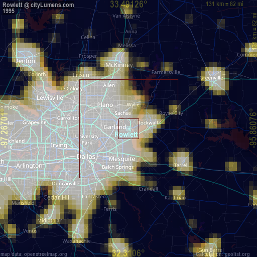
» NASA, Earths city lights 1995
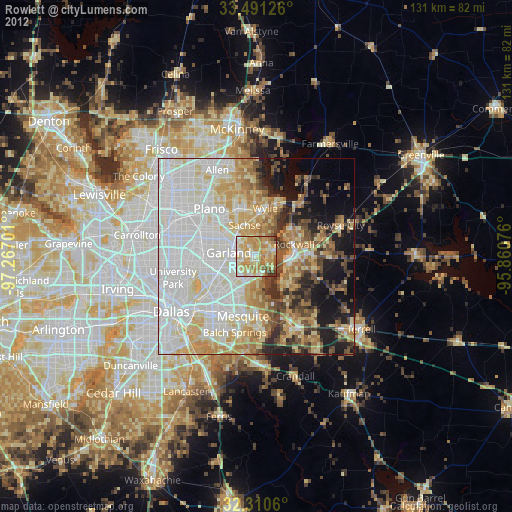
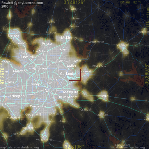
» NASA city lights 2003
» Earth at Night: Flat Maps 2012, 2016