Sunland Park night lights from space
Night Light of Sunland Park (New Mexico) from space (United States) Src. Average luminocity for 10x10km area is 58.2527% and for 50x50km: 37.1753%.
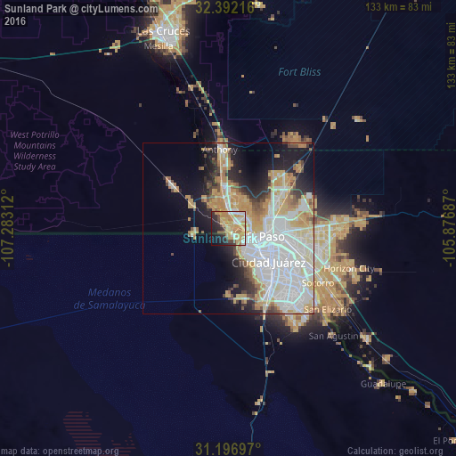
Analysis of Sunland Park night lights 2016
Square area 10x10 km:
 7.69%
7.69%90-99
7.33%80-89
8.61%70-79
26.01%60-69
10.62%50-59
3.11%40-49
3.48%30-39
4.03%20-29
12.45%10-19
12.64%0-9
4.03%Square area 50x50 km:
12.62%90-99
7.29%80-89
3.77%70-79
7.28%60-69
3.82%50-59
2.36%40-49
2.72%30-39
1.91%20-29
5.05%10-19
8.86%0-9
44.3%Clear (daylight) street map image can be seen on geolist.org.
Map coordinates:
32° 23' 31.8" North, 107° 16' 59.2" West
31° 47' 47.4" North, 106° 34' 48" West
31° 11' 49.1" North, 105° 52' 36.7" West
Some cities around Sunland Park sort by population:
• Juárez, MX
14.1 km =8.8 mi,  126°
126°
• El Paso
9.7 km =6 mi,  115°
115°
• Socorro
30.6 km =19 mi, 121°
• Chaparral
31.2 km =19.4 mi,  35°
35°
• Anthony
23.2 km =14.4 mi,  353°
353°
• Fort Bliss
16 km =9.9 mi,  83°
83°
• Canutillo
12.9 km =8 mi, 351°
• Anthony
22.7 km =14.1 mi, 353°
5493403 (p: 15,940)
Sources (retrieved 2019-11-25):
» Earth at Night: Flat Maps 2012, 2016