Sumner night lights from space
Night Light of Sumner (Washington) from space (United States) Src. Average luminocity for 10x10km area is 66.061% and for 50x50km: 34.1922%.
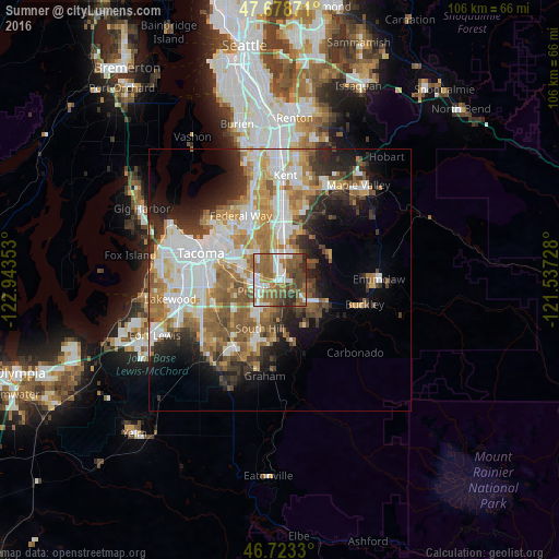
Analysis of Sumner night lights 2016
Square area 10x10 km:
 13.84%
90-99
12.35%80-89
2.98%70-79
5.65%60-69
19.2%50-59
22.02%40-49
12.05%30-39
5.65%20-29
6.25%10-19
0%0-9
0%Square area 50x50 km:
7.91%90-99
7.09%80-89
3.03%70-79
4.81%60-69
5.98%50-59
5.89%40-49
3.79%30-39
3.87%20-29
5.54%10-19
7.97%0-9
44.13%Clear (daylight) street map image can be seen on geolist.org.
Map coordinates:
47° 40' 43.4" North, 122° 56' 36.7" West
47° 12' 11.4" North, 122° 14' 25.4" West
46° 43' 23.9" North, 121° 32' 14.2" West
Some cities around Sumner sort by population:
• South Hill
7.2 km =4.5 mi,  198°
198°
• Puyallup
4.4 km =2.7 mi,  243°
243°
• Bonney Lake
5 km =3.1 mi,  125°
125°
• Lakeland South
9 km =5.6 mi,  338°
338°
• Edgewood
6.6 km =4.1 mi,  322°
322°
• Waller
9.7 km =6 mi,  268°
268°
• Milton
7.4 km =4.6 mi,  312°
312°
• Pacific
6.9 km =4.3 mi,  353°
353°
5812543 (p: 9,700)
Sources (retrieved 2019-11-25):
» Earth at Night: Flat Maps 2012, 2016