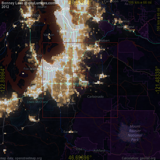
Bonney Lake night lights from space
Night Light of Bonney Lake (Washington) from space (United States) Src. Average luminocity for 10x10km area is 45.503% and for 50x50km: 29.6432%.
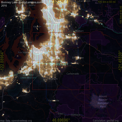
Analysis of Bonney Lake night lights 2016
Square area 10x10 km:
 5.8%
5.8%90-99
5.06%80-89
0.45%70-79
1.93%60-69
8.18%50-59
15.18%40-49
22.47%30-39
12.2%20-29
13.69%10-19
13.84%0-9
1.19%Square area 50x50 km:
7.03%90-99
6.13%80-89
2.51%70-79
4.11%60-69
5.03%50-59
5.44%40-49
3.46%30-39
3.29%20-29
4.45%10-19
6.42%0-9
52.14%Clear (daylight) street map image can be seen on geolist.org.
Map coordinates:
47° 39' 10.2" North, 122° 53' 22.7" West
47° 10' 37.4" North, 122° 11' 11.4" West
46° 41' 49.1" North, 121° 29' 0.2" West
Some cities around Bonney Lake sort by population:
• South Hill
7.5 km =4.7 mi,  237°
237°
• Puyallup
8.1 km =5 mi,  276°
276°
• Prairie Ridge
5.2 km =3.2 mi,  146°
146°
• Edgewood
11.5 km =7.1 mi,  315°
315°
• Sumner
5 km =3.1 mi,  305°
305°
• Milton
12.4 km =7.7 mi, 309°
• Orting
8.9 km =5.5 mi,  188°
188°
• Pacific
10.9 km =6.8 mi,  333°
333°
5787776 (p: 19,903)
Sources (retrieved 2019-11-25):
» Earth at Night: Flat Maps 2012, 2016