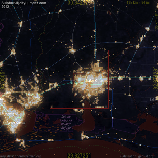
Sulphur night lights from space
Night Light of Sulphur (Louisiana) from space (United States) Src. Average luminocity for 10x10km area is 56.6871% and for 50x50km: 20.7183%.
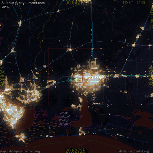
Analysis of Sulphur night lights 2016
Square area 10x10 km:
 8.74%
8.74%90-99
11.19%80-89
8.22%70-79
9.44%60-69
10.49%50-59
7.69%40-49
6.29%30-39
13.64%20-29
12.76%10-19
10.66%0-9
0.87%Square area 50x50 km:
3.14%90-99
3.08%80-89
2.61%70-79
2.4%60-69
3.76%50-59
4.97%40-49
3.13%30-39
3.48%20-29
3.78%10-19
7.97%0-9
61.69%Clear (daylight) street map image can be seen on geolist.org.
Map coordinates:
30° 50' 31.8" North, 94° 4' 49.8" West
30° 14' 11.7" North, 93° 22' 38.6" West
29° 37' 38.1" North, 92° 40' 27.3" West
Some cities around Sulphur sort by population:
• Lake Charles
16.8 km =10.4 mi,  98°
98°
• Orange
38 km =23.6 mi,  245°
245°
• Groves
61 km =37.9 mi,  238°
238°
• Port Neches
62.2 km =38.6 mi, 243°
• Moss Bluff
19.4 km =12.1 mi,  67°
67°
• Vidor
62.4 km =38.8 mi,  259°
259°
• Bridge City
51 km =31.7 mi, 241°
• Prien
11.7 km =7.3 mi,  121°
121°
4342816 (p: 20,189)
Sources (retrieved 2019-11-25):
» Earth at Night: Flat Maps 2012, 2016