Port Neches night lights from space
Night Light of Port Neches (Texas) from space (United States) Src. Average luminocity for 10x10km area is 71.483% and for 50x50km: 33.5436%.
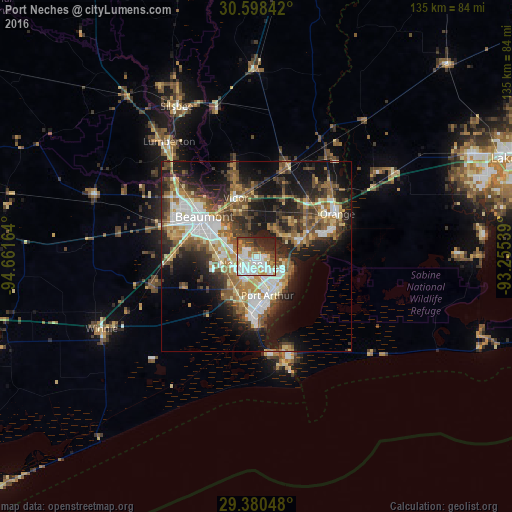
Analysis of Port Neches night lights 2016
Square area 10x10 km:
 22.92%
90-99
19.32%80-89
8.9%70-79
5.68%60-69
7.01%50-59
7.01%40-49
10.23%30-39
4.55%20-29
13.26%10-19
1.14%0-9
0%Square area 50x50 km:
6.03%90-99
5.51%80-89
4.31%70-79
3.45%60-69
5.26%50-59
5.97%40-49
5.17%30-39
5.65%20-29
8.99%10-19
15.93%0-9
33.74%Clear (daylight) street map image can be seen on geolist.org.
Map coordinates:
30° 35' 54.3" North, 94° 39' 41.9" West
29° 59' 28.8" North, 93° 57' 30.6" West
29° 22' 49.7" North, 93° 15' 19.4" West
Some cities around Port Neches sort by population:
• Beaumont
17.4 km =10.8 mi,  307°
307°
• Orange
24.2 km =15 mi,  62°
62°
• Nederland
3.8 km =2.4 mi,  240°
240°
• Groves
6.2 km =3.9 mi,  140°
140°
• Lumberton
38.3 km =23.8 mi,  322°
322°
• Vidor
16.5 km =10.3 mi,  340°
340°
• Bridge City
11.3 km =7 mi,  73°
73°
• Silsbee
45 km =28 mi,  332°
332°
4720072 (p: 12,786)
Sources (retrieved 2019-11-25):
» Earth at Night: Flat Maps 2012, 2016