Vidor night lights from space
Night Light of Vidor (Texas) from space (United States) Src. Average luminocity for 10x10km area is 48.5833% and for 50x50km: 32.2523%.
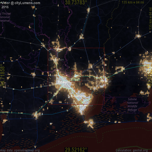
Analysis of Vidor night lights 2016
Square area 10x10 km:
 2.46%
2.46%90-99
2.84%80-89
6.63%70-79
5.68%60-69
15.53%50-59
14.77%40-49
10.98%30-39
14.2%20-29
17.23%10-19
9.66%0-9
0%Square area 50x50 km:
5.17%90-99
4.81%80-89
4%70-79
3.49%60-69
5.03%50-59
6%40-49
5.86%30-39
5.79%20-29
8.76%10-19
16.52%0-9
34.55%Clear (daylight) street map image can be seen on geolist.org.
Map coordinates:
30° 44' 16.2" North, 94° 43' 6.9" West
30° 7' 53.8" North, 94° 0' 55.6" West
29° 31' 17.8" North, 93° 18' 44.4" West
Some cities around Vidor sort by population:
• Beaumont
9.7 km =6 mi,  238°
238°
• Port Arthur
28.3 km =17.6 mi,  165°
165°
• Orange
27.2 km =16.9 mi,  99°
99°
• Nederland
17.6 km =10.9 mi, 172°
• Groves
22.5 km =14 mi,  155°
155°
• Port Neches
16.5 km =10.3 mi, 160°
• Lumberton
23.1 km =14.4 mi,  310°
310°
• Bridge City
20.5 km =12.7 mi,  127°
127°
4739226 (p: 10,945)
Sources (retrieved 2019-11-25):
» Earth at Night: Flat Maps 2012, 2016