Suamico night lights from space
Night Light of Suamico (Wisconsin) from space (United States) Src. Average luminocity for 10x10km area is 13.5242% and for 50x50km: 11.7982%.
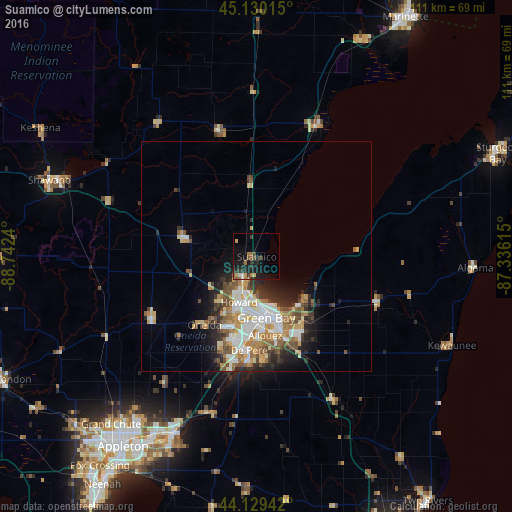
Analysis of Suamico night lights 2016
Square area 10x10 km:
 0.45%
0.45%90-99
1.06%80-89
0.61%70-79
2.42%60-69
2.73%50-59
2.12%40-49
1.67%30-39
2.58%20-29
6.52%10-19
14.55%0-9
65.3%Square area 50x50 km:
2.06%90-99
2.27%80-89
1.35%70-79
1.73%60-69
1.67%50-59
1.66%40-49
1.74%30-39
1.25%20-29
3.02%10-19
4.22%0-9
79.03%Clear (daylight) street map image can be seen on geolist.org.
Map coordinates:
45° 7' 48.5" North, 88° 44' 32.6" West
44° 37' 55" North, 88° 2' 21.4" West
44° 7' 45.9" North, 87° 20' 10.1" West
Some cities around Suamico sort by population:
• Green Bay
12.6 km =7.8 mi,  173°
173°
• De Pere
20.4 km =12.7 mi,  184°
184°
• Howard
10.6 km =6.6 mi,  201°
201°
• Ashwaubenon
16.8 km =10.4 mi,  188°
188°
• Kaukauna
43.5 km =27 mi,  205°
205°
• Bellevue
22.9 km =14.2 mi,  155°
155°
• Allouez
17.3 km =10.7 mi, 173°
• Hobart
17.2 km =10.7 mi, 210°
5274887 (p: 12,187)
Sources (retrieved 2019-11-25):
» Earth at Night: Flat Maps 2012, 2016