Green Bay night lights from space
Night Light of Green Bay (Wisconsin) from space (United States) Src. Average luminocity for 10x10km area is 82.8778% and for 50x50km: 13.5684%.
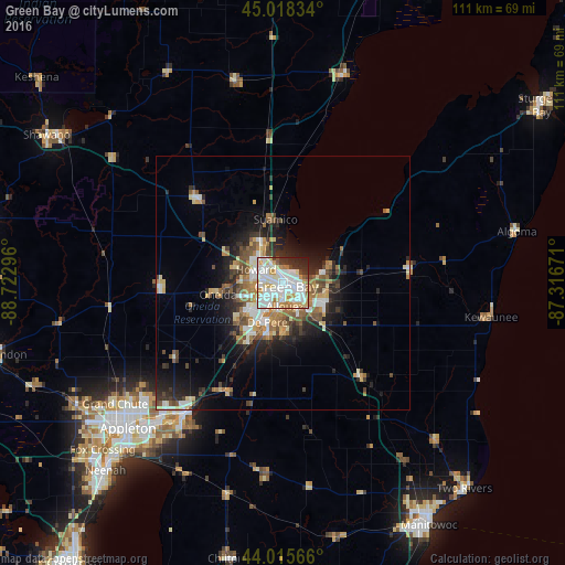

Analysis of Green Bay night lights 2016
Square area 10x10 km:
 30.95%
90-99
29.68%80-89
7.78%70-79
10.48%60-69
5.56%50-59
1.59%40-49
1.75%30-39
4.76%20-29
6.83%10-19
0.63%0-9
0%Square area 50x50 km:
2.16%90-99
2.51%80-89
1.61%70-79
1.85%60-69
1.8%50-59
1.81%40-49
1.99%30-39
1.62%20-29
3.84%10-19
6.1%0-9
74.71%Clear (daylight) street map image can be seen on geolist.org.
Map coordinates:
45° 1' 6" North, 88° 43' 22.7" West
44° 31' 9" North, 88° 1' 11.4" West
44° 0' 56.4" North, 87° 19' 0.2" West
Some cities around Green Bay sort by population:
• De Pere
8.5 km =5.3 mi,  202°
202°
• Howard
6.1 km =3.8 mi,  296°
296°
• Ashwaubenon
5.7 km =3.5 mi,  224°
224°
• Kaukauna
33.5 km =20.8 mi, 216°
• Bellevue
11.5 km =7.1 mi,  136°
136°
• Allouez
4.6 km =2.9 mi,  176°
176°
• Suamico
12.6 km =7.8 mi,  353°
353°
• Hobart
10.5 km =6.5 mi,  257°
257°
5254962 (p: 105,207)
Sources (retrieved 2019-11-25):
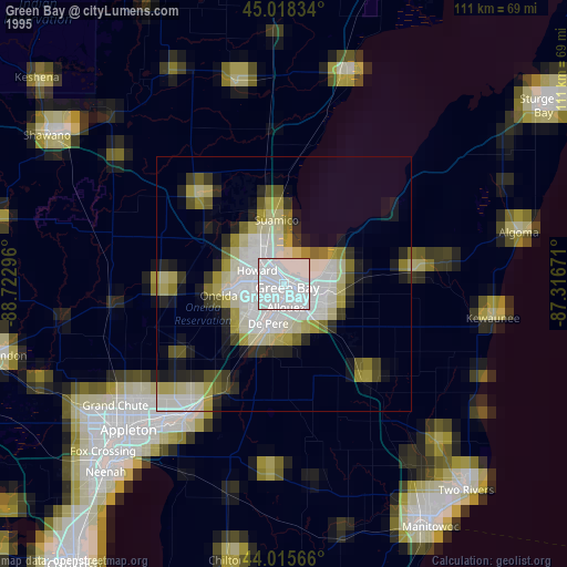
» NASA, Earths city lights 1995
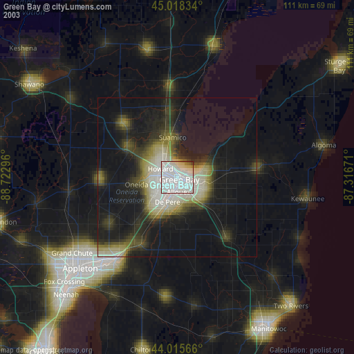
» NASA city lights 2003
» Earth at Night: Flat Maps 2012, 2016