Streator night lights from space
Night Light of Streator (Illinois) from space (United States) Src. Average luminocity for 10x10km area is 22.9594% and for 50x50km: 5.5288%.
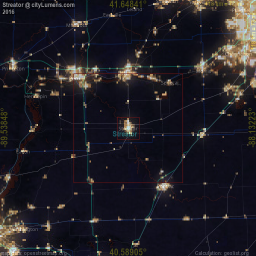
Analysis of Streator night lights 2016
Square area 10x10 km:
 2.44%
2.44%90-99
1.62%80-89
5.19%70-79
2.6%60-69
3.08%50-59
4.55%40-49
2.11%30-39
2.76%20-29
4.38%10-19
17.37%0-9
53.9%Square area 50x50 km:
0.35%90-99
0.42%80-89
1.2%70-79
0.62%60-69
0.67%50-59
0.91%40-49
0.9%30-39
0.77%20-29
1.47%10-19
3.81%0-9
88.88%Clear (daylight) street map image can be seen on geolist.org.
Map coordinates:
41° 38' 54.3" North, 89° 32' 18.5" West
41° 7' 15.1" North, 88° 50' 7.3" West
40° 35' 20.6" North, 88° 7' 56" West
Some cities around Streator sort by population:
• Ottawa
25 km =15.5 mi,  358°
358°
• Morris
43.5 km =27 mi,  52°
52°
• Pontiac
31.8 km =19.8 mi,  147°
147°
• Peru
33.6 km =20.9 mi,  313°
313°
• La Salle
31.9 km =19.8 mi,  317°
317°
• Mendota
52.9 km =32.9 mi,  333°
333°
• Coal City
49.6 km =30.8 mi,  68°
68°
• Spring Valley
38.2 km =23.7 mi, 307°
4912698 (p: 13,182)
Sources (retrieved 2019-11-25):
» Earth at Night: Flat Maps 2012, 2016