La Salle night lights from space
Night Light of La Salle (Illinois) from space (United States) Src. Average luminocity for 10x10km area is 52.6701% and for 50x50km: 8.7843%.
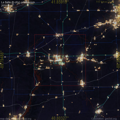
Analysis of La Salle night lights 2016
Square area 10x10 km:
 8.84%
8.84%90-99
7.82%80-89
10.71%70-79
3.57%60-69
9.52%50-59
6.97%40-49
11.22%30-39
8.67%20-29
17.86%10-19
14.8%0-9
0%Square area 50x50 km:
0.73%90-99
0.67%80-89
1.65%70-79
0.97%60-69
1.28%50-59
1.3%40-49
1.56%30-39
1.43%20-29
2.34%10-19
6.57%0-9
81.49%Clear (daylight) street map image can be seen on geolist.org.
Map coordinates:
41° 51' 33.1" North, 89° 47' 41.6" West
41° 20' 0.1" North, 89° 5' 30.3" West
40° 48' 11.8" North, 88° 23' 19.1" West
Some cities around La Salle sort by population:
• Ottawa
20.8 km =12.9 mi,  86°
86°
• Morris
56 km =34.8 mi, 87°
• Streator
31.9 km =19.8 mi,  137°
137°
• Peru
3.2 km =2 mi,  258°
258°
• Princeton
31.4 km =19.5 mi,  277°
277°
• Sandwich
52.3 km =32.5 mi,  48°
48°
• Mendota
23.9 km =14.9 mi,  354°
354°
• Spring Valley
9 km =5.6 mi,  265°
265°
4898875 (p: 9,609)
Sources (retrieved 2019-11-25):
» Earth at Night: Flat Maps 2012, 2016