Peru night lights from space
Night Light of Peru (Illinois) from space (United States) Src. Average luminocity for 10x10km area is 48.9422% and for 50x50km: 7.9081%.
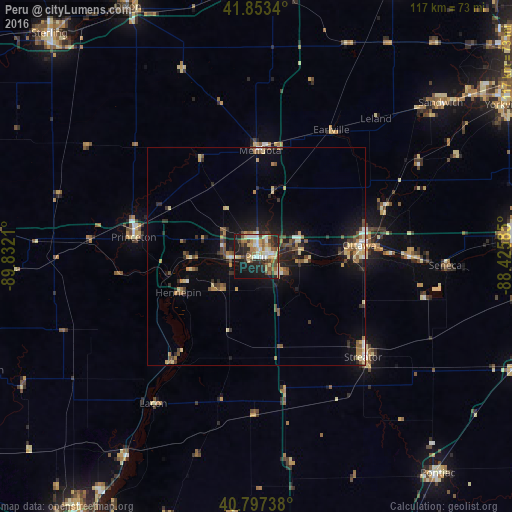
Analysis of Peru night lights 2016
Square area 10x10 km:
 7.82%
7.82%90-99
6.8%80-89
11.22%70-79
3.74%60-69
9.69%50-59
4.76%40-49
9.52%30-39
5.78%20-29
13.95%10-19
23.81%0-9
2.89%Square area 50x50 km:
0.66%90-99
0.59%80-89
1.51%70-79
0.88%60-69
1.12%50-59
1.18%40-49
1.41%30-39
1.25%20-29
2.08%10-19
5.58%0-9
83.75%Clear (daylight) street map image can be seen on geolist.org.
Map coordinates:
41° 51' 12.2" North, 89° 49' 55.6" West
41° 19' 39.1" North, 89° 7' 44.3" West
40° 47' 50.6" North, 88° 25' 33.1" West
Some cities around Peru sort by population:
• Ottawa
24 km =14.9 mi,  85°
85°
• Streator
33.6 km =20.9 mi,  133°
133°
• La Salle
3.2 km =2 mi,  78°
78°
• Princeton
28.4 km =17.6 mi,  279°
279°
• Sandwich
55.1 km =34.2 mi,  50°
50°
• Mendota
24.4 km =15.2 mi,  2°
2°
• Chillicothe
54.1 km =33.6 mi,  213°
213°
• Spring Valley
5.9 km =3.7 mi,  270°
270°
4905770 (p: 9,952)
Sources (retrieved 2019-11-25):
» Earth at Night: Flat Maps 2012, 2016