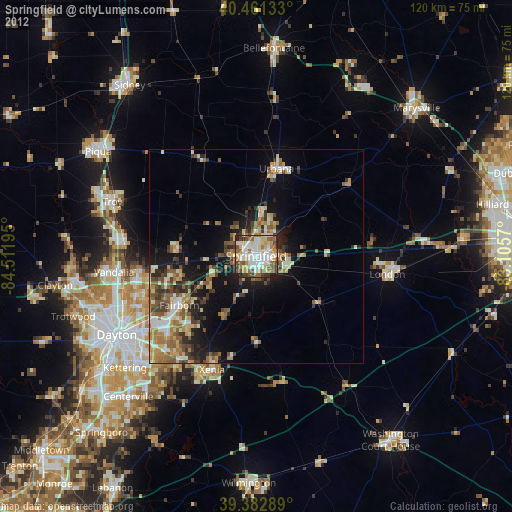
Springfield night lights from space
Night Light of Springfield (Ohio) from space (United States) Src. Average luminocity for 10x10km area is 72.8163% and for 50x50km: 15.2366%.

Analysis of Springfield night lights 2016
Square area 10x10 km:
 20.07%
90-99
23.64%80-89
6.12%70-79
9.35%60-69
6.63%50-59
4.93%40-49
13.1%30-39
10.54%20-29
5.1%10-19
0.51%0-9
0%Square area 50x50 km:
1.69%90-99
2.48%80-89
1.9%70-79
1.72%60-69
2.32%50-59
2.71%40-49
2.61%30-39
3.24%20-29
4.11%10-19
8.14%0-9
69.09%Clear (daylight) street map image can be seen on geolist.org.
Map coordinates:
40° 27' 40.8" North, 84° 30' 43" West
39° 55' 27.2" North, 83° 48' 31.8" West
39° 22' 58.4" North, 83° 6' 20.5" West
Some cities around Springfield sort by population:
• Huber Heights
28.4 km =17.6 mi,  251°
251°
• Fairborn
21.3 km =13.2 mi,  237°
237°
• Xenia
28.6 km =17.8 mi,  201°
201°
• Urbana
21 km =13 mi,  13°
13°
• London
31 km =19.3 mi,  97°
97°
• Tipp City
31.2 km =19.4 mi,  276°
276°
• Northridge
7.9 km =4.9 mi,  18°
18°
• New Carlisle
18.5 km =11.5 mi,  274°
274°
4525353 (p: 59,680)
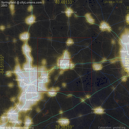
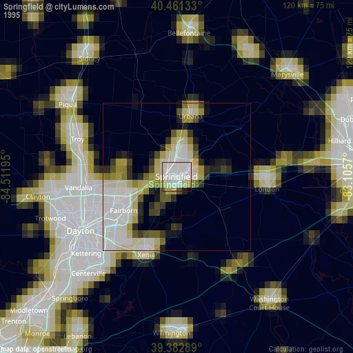
Sources (retrieved 2019-11-25):
» NASA, Earths city lights 1995
» NASA city lights 2003
» Earth at Night: Flat Maps 2012, 2016