Xenia night lights from space
Night Light of Xenia (Ohio) from space (United States) Src. Average luminocity for 10x10km area is 37.7873% and for 50x50km: 27.3019%.
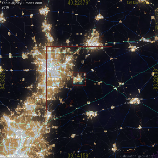
Analysis of Xenia night lights 2016
Square area 10x10 km:
 2.27%
2.27%90-99
4.87%80-89
5.84%70-79
7.31%60-69
8.28%50-59
6.01%40-49
5.03%30-39
4.71%20-29
13.31%10-19
30.52%0-9
11.85%Square area 50x50 km:
5.06%90-99
5.45%80-89
3.66%70-79
4.18%60-69
4.27%50-59
3.82%40-49
3.53%30-39
3.66%20-29
4.76%10-19
8.7%0-9
52.92%Clear (daylight) street map image can be seen on geolist.org.
Map coordinates:
40° 13' 25.5" North, 84° 37' 58" West
39° 41' 5.2" North, 83° 55' 46.7" West
39° 8' 29.6" North, 83° 13' 35.5" West
Some cities around Xenia sort by population:
• Dayton
23.9 km =14.9 mi,  290°
290°
• Kettering
20.5 km =12.7 mi,  271°
271°
• Beavercreek
11.8 km =7.3 mi,  283°
283°
• Fairborn
17 km =10.6 mi,  333°
333°
• Riverside
19.7 km =12.2 mi,  302°
302°
• Centerville
20.6 km =12.8 mi,  252°
252°
• Oakwood
21.4 km =13.3 mi, 282°
• Bellbrook
13.3 km =8.3 mi, 245°
4528810 (p: 25,976)
Sources (retrieved 2019-11-25):
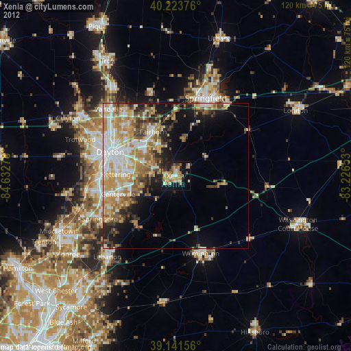
» Earth at Night: Flat Maps 2012, 2016