Sparks night lights from space
Night Light of Sparks (Nevada) from space (United States) Src. Average luminocity for 10x10km area is 83.2045% and for 50x50km: 15.2136%.
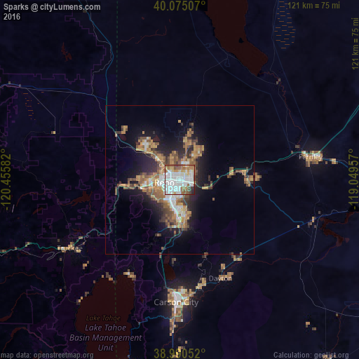
Analysis of Sparks night lights 2016
Square area 10x10 km:
 35.71%
90-99
23.86%80-89
4.22%70-79
7.79%60-69
9.58%50-59
9.58%40-49
4.71%30-39
2.27%20-29
2.27%10-19
0%0-9
0%Square area 50x50 km:
2.41%90-99
2.1%80-89
0.76%70-79
2.88%60-69
2.96%50-59
3%40-49
2.17%30-39
2.22%20-29
3.38%10-19
7.39%0-9
70.73%Clear (daylight) street map image can be seen on geolist.org.
Map coordinates:
40° 4' 30.3" North, 120° 27' 21" West
39° 32' 5.7" North, 119° 45' 9.7" West
38° 59' 25.9" North, 119° 2' 58.5" West
Some cities around Sparks sort by population:
• Reno
5.3 km =3.3 mi,  263°
263°
• Carson City
41.3 km =25.7 mi,  181°
181°
• Sun Valley
7.1 km =4.4 mi,  343°
343°
• Spanish Springs
13.3 km =8.3 mi,  16°
16°
• Dayton
35.8 km =22.2 mi,  157°
157°
• Incline Village
36.8 km =22.9 mi,  210°
210°
• Cold Springs
25.1 km =15.6 mi,  310°
310°
• Lemmon Valley
13.7 km =8.5 mi,  325°
325°
5512862 (p: 96,094)
Sources (retrieved 2019-11-25):
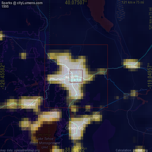
» NASA, Earths city lights 1995
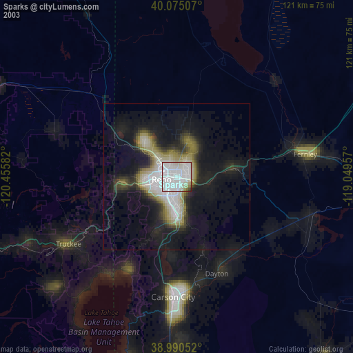
» NASA city lights 2003
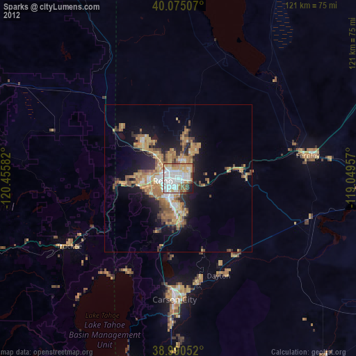
» Earth at Night: Flat Maps 2012, 2016