Carson City night lights from space
Night Light of Carson City (Nevada) from space (United States) Src. Average luminocity for 10x10km area is 46.7062% and for 50x50km: 5.6742%.
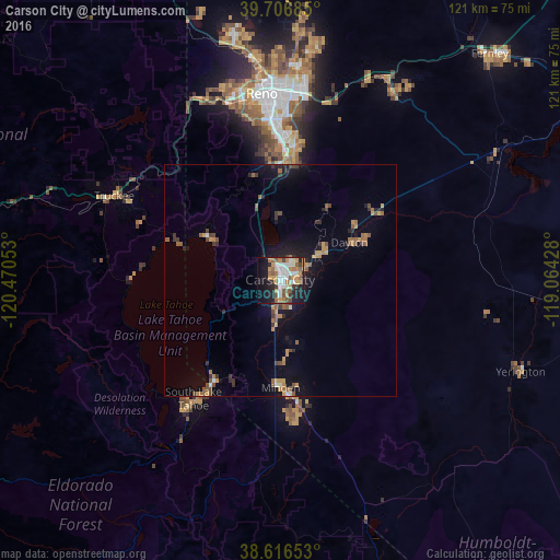
Analysis of Carson City night lights 2016
Square area 10x10 km:
 7.47%
7.47%90-99
10.55%80-89
3.25%70-79
9.09%60-69
7.63%50-59
7.63%40-49
4.38%30-39
5.52%20-29
11.04%10-19
23.54%0-9
9.9%Square area 50x50 km:
0.36%90-99
0.56%80-89
0.3%70-79
1.16%60-69
0.85%50-59
1.3%40-49
0.7%30-39
0.92%20-29
1.1%10-19
4.52%0-9
88.22%Clear (daylight) street map image can be seen on geolist.org.
Map coordinates:
39° 42' 24.7" North, 120° 28' 13.9" West
39° 9' 49.7" North, 119° 46' 2.6" West
38° 36' 59.5" North, 119° 3' 51.4" West
Some cities around Carson City sort by population:
• South Lake Tahoe
31.8 km =19.8 mi,  216°
216°
• Truckee
40.2 km =25 mi,  297°
297°
• Gardnerville Ranchos
30.7 km =19.1 mi,  175°
175°
• Dayton
17.1 km =10.6 mi,  61°
61°
• Incline Village
20.2 km =12.6 mi, 298°
• Johnson Lane
13.5 km =8.4 mi,  163°
163°
• Gardnerville
24.8 km =15.4 mi, 176°
• Indian Hills
8.8 km =5.5 mi,  189°
189°
5501344 (p: 54,521)
Sources (retrieved 2019-11-25):
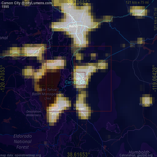
» NASA, Earths city lights 1995
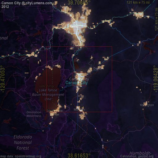
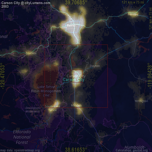
» NASA city lights 2003
» Earth at Night: Flat Maps 2012, 2016