South Yarmouth night lights from space
Night Light of South Yarmouth (Massachusetts) from space (United States) Src. Average luminocity for 10x10km area is 32.4042% and for 50x50km: 5.5085%.
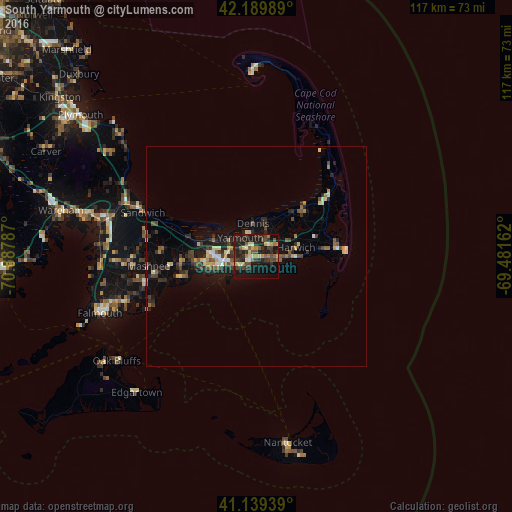
Analysis of South Yarmouth night lights 2016
Square area 10x10 km:
 1.14%
1.14%90-99
3.73%80-89
4.22%70-79
4.06%60-69
4.22%50-59
5.84%40-49
7.79%30-39
9.25%20-29
14.29%10-19
32.31%0-9
13.15%Square area 50x50 km:
0.2%90-99
0.64%80-89
0.64%70-79
0.65%60-69
0.65%50-59
0.84%40-49
1.16%30-39
0.98%20-29
2.15%10-19
4.4%0-9
87.71%Clear (daylight) street map image can be seen on geolist.org.
Map coordinates:
42° 11' 23.6" North, 70° 53' 16.3" West
41° 40' 0.4" North, 70° 11' 5.1" West
41° 8' 21.8" North, 69° 28' 53.8" West
Some cities around South Yarmouth sort by population:
• Barnstable
10.2 km =6.3 mi,  291°
291°
• Yarmouth
5.7 km =3.5 mi,  319°
319°
• Hyannis
8.3 km =5.2 mi,  259°
259°
• Harwich
9.3 km =5.8 mi,  76°
76°
• Centerville
13.7 km =8.5 mi, 261°
• Marstons Mills
19.3 km =12 mi,  266°
266°
• West Yarmouth
5 km =3.1 mi,  248°
248°
• Yarmouth Port
6.7 km =4.2 mi,  306°
306°
4951579 (p: 11,092)
Sources (retrieved 2019-11-25):
» Earth at Night: Flat Maps 2012, 2016