Barnstable night lights from space
Night Light of Barnstable (Massachusetts) from space (United States) Src. Average luminocity for 10x10km area is 27.0195% and for 50x50km: 8.0963%.
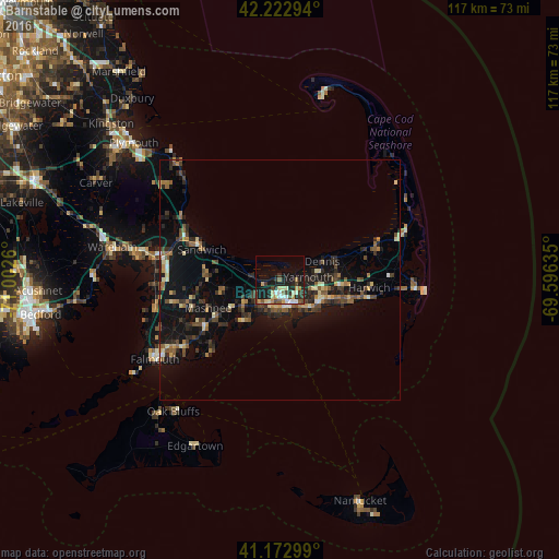
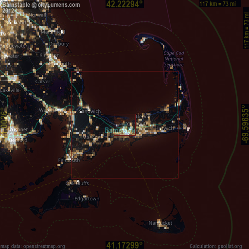
Analysis of Barnstable night lights 2016
Square area 10x10 km:
 2.76%
2.76%90-99
5.19%80-89
3.9%70-79
4.06%60-69
2.11%50-59
2.76%40-49
3.9%30-39
4.22%20-29
8.6%10-19
23.38%0-9
39.12%Square area 50x50 km:
0.3%90-99
0.73%80-89
0.98%70-79
0.8%60-69
1.07%50-59
1.33%40-49
1.68%30-39
1.45%20-29
2.91%10-19
9.14%0-9
79.61%Clear (daylight) street map image can be seen on geolist.org.
Map coordinates:
42° 13' 22.6" North, 71° 0' 9.4" West
41° 42' 0.4" North, 70° 17' 58.1" West
41° 10' 22.8" North, 69° 35' 46.9" West
Some cities around Barnstable sort by population:
• Yarmouth
5.9 km =3.7 mi,  83°
83°
• Mashpee
16.1 km =10 mi,  249°
249°
• Hyannis
5.4 km =3.4 mi,  165°
165°
• South Yarmouth
10.2 km =6.3 mi,  111°
111°
• Centerville
7 km =4.3 mi,  215°
215°
• Marstons Mills
10.8 km =6.7 mi,  243°
243°
• West Yarmouth
7.4 km =4.6 mi,  138°
138°
• Yarmouth Port
4.2 km =2.6 mi,  87°
87°
4929771 (p: 47,821)
Sources (retrieved 2019-11-25):
» Earth at Night: Flat Maps 2012, 2016