South River night lights from space
Night Light of South River (New Jersey) from space (United States) Src. Average luminocity for 10x10km area is 80.8299% and for 50x50km: 67.1345%.
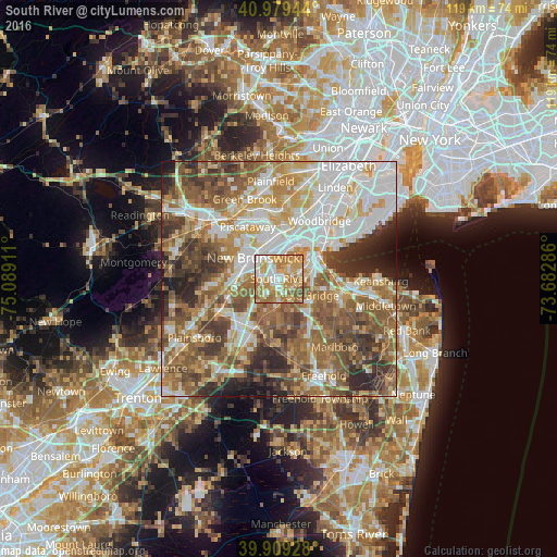
Analysis of South River night lights 2016
Square area 10x10 km:
 14.97%
90-99
19.05%80-89
14.8%70-79
23.47%60-69
22.45%50-59
4.93%40-49
0.34%30-39
0%20-29
0%10-19
0%0-9
0%Square area 50x50 km:
14.99%90-99
13.62%80-89
8.6%70-79
10%60-69
12.31%50-59
14.13%40-49
8.55%30-39
7.77%20-29
7.04%10-19
2.69%0-9
0.3%Clear (daylight) street map image can be seen on geolist.org.
Map coordinates:
40° 58' 46" North, 75° 5' 20.8" West
40° 26' 47.4" North, 74° 23' 9.5" West
39° 54' 33.4" North, 73° 40' 58.3" West
Some cities around South River sort by population:
• Piscataway
6 km =3.7 mi,  349°
349°
• East Brunswick
3.3 km =2.1 mi,  230°
230°
• Sayreville
2.5 km =1.6 mi,  56°
56°
• Sayreville Junction
5.1 km =3.2 mi,  65°
65°
• Old Bridge
3.9 km =2.4 mi,  153°
153°
• Highland Park
6.4 km =4 mi,  329°
329°
• Spotswood
6.2 km =3.9 mi,  189°
189°
• Milltown
5 km =3.1 mi,  282°
282°
5104853 (p: 16,399)
Sources (retrieved 2019-11-25):
» Earth at Night: Flat Maps 2012, 2016