Milltown night lights from space
Night Light of Milltown (New Jersey) from space (United States) Src. Average luminocity for 10x10km area is 85.8656% and for 50x50km: 64.941%.
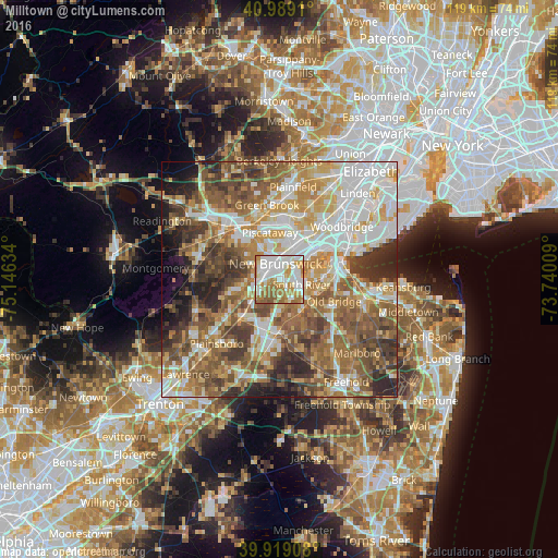
Analysis of Milltown night lights 2016
Square area 10x10 km:
 28.91%
90-99
27.21%80-89
6.97%70-79
14.46%60-69
16.67%50-59
5.61%40-49
0.17%30-39
0%20-29
0%10-19
0%0-9
0%Square area 50x50 km:
13.86%90-99
13.17%80-89
8.5%70-79
9.99%60-69
11.86%50-59
13.2%40-49
8.66%30-39
7.77%20-29
6.89%10-19
3.94%0-9
2.16%Clear (daylight) street map image can be seen on geolist.org.
Map coordinates:
40° 59' 20.8" North, 75° 8' 46.8" West
40° 27' 22.4" North, 74° 26' 35.6" West
39° 55' 8.7" North, 73° 44' 24.3" West
Some cities around Milltown sort by population:
• New Brunswick
3.4 km =2.1 mi,  347°
347°
• Piscataway
6.1 km =3.8 mi,  37°
37°
• East Brunswick
3.9 km =2.4 mi,  143°
143°
• Voorhees
4.4 km =2.7 mi,  309°
309°
• Somerset
6 km =3.7 mi,  320°
320°
• South River
5 km =3.1 mi,  102°
102°
• Highland Park
4.7 km =2.9 mi,  19°
19°
• East Franklin
4.8 km =3 mi,  330°
330°
5101244 (p: 7,049)
Sources (retrieved 2019-11-25):
» Earth at Night: Flat Maps 2012, 2016