South Kingstown night lights from space
Night Light of South Kingstown (Rhode Island) from space (United States) Src. Average luminocity for 10x10km area is 22.4218% and for 50x50km: 10.1075%.
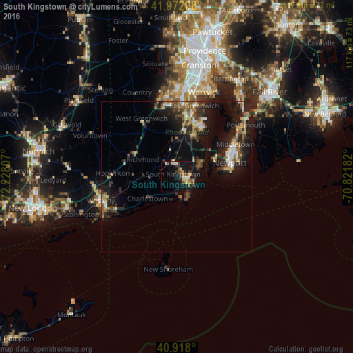
Analysis of South Kingstown night lights 2016
Square area 10x10 km:
 0.68%
0.68%90-99
3.91%80-89
4.59%70-79
2.72%60-69
2.21%50-59
2.72%40-49
4.76%30-39
3.91%20-29
1.7%10-19
28.91%0-9
43.88%Square area 50x50 km:
0.8%90-99
1.27%80-89
1.29%70-79
0.99%60-69
1.31%50-59
1.58%40-49
1.76%30-39
1.82%20-29
3.62%10-19
9.72%0-9
75.84%Clear (daylight) street map image can be seen on geolist.org.
Map coordinates:
41° 58' 19.5" North, 72° 13' 41.1" West
41° 26' 49.8" North, 71° 31' 29.8" West
40° 55' 4.8" North, 70° 49' 18.6" West
Some cities around South Kingstown sort by population:
• North Kingstown
12.4 km =7.7 mi,  23°
23°
• Newport
18.3 km =11.4 mi,  74°
74°
• Narragansett
6.3 km =3.9 mi,  87°
87°
• Wakefield-Peacedale
2 km =1.2 mi, 93°
• Charlestown
12.1 km =7.5 mi,  233°
233°
• Kingston
3.7 km =2.3 mi,  3°
3°
• Exeter
14.5 km =9 mi,  355°
355°
• Jamestown
14.3 km =8.9 mi, 67°
8436572 (p: 30,826)
Sources (retrieved 2019-11-25):
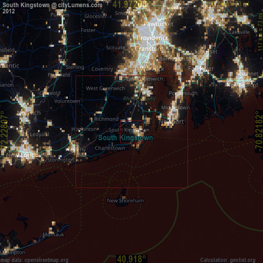
» Earth at Night: Flat Maps 2012, 2016