Jamestown night lights from space
Night Light of Jamestown (Rhode Island) from space (United States) Src. Average luminocity for 10x10km area is 27.3401% and for 50x50km: 15.6511%.
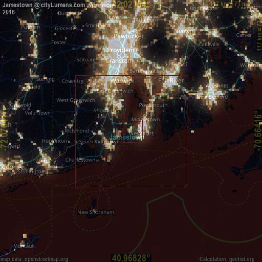
Analysis of Jamestown night lights 2016
Square area 10x10 km:
 4.93%
4.93%90-99
5.1%80-89
4.42%70-79
1.36%60-69
0.17%50-59
2.21%40-49
3.57%30-39
4.08%20-29
13.1%10-19
18.71%0-9
42.35%Square area 50x50 km:
1.73%90-99
2.35%80-89
2.04%70-79
1.87%60-69
2.17%50-59
2.4%40-49
2.38%30-39
2.63%20-29
5.75%10-19
11.4%0-9
65.27%Clear (daylight) street map image can be seen on geolist.org.
Map coordinates:
42° 1' 17.5" North, 72° 4' 13.5" West
41° 29' 49.4" North, 71° 22' 2.2" West
40° 58' 5.8" North, 70° 39' 51" West
Some cities around Jamestown sort by population:
• South Kingstown
14.3 km =8.9 mi,  247°
247°
• North Kingstown
10.1 km =6.3 mi,  305°
305°
• Newport
4.6 km =2.9 mi,  99°
99°
• Middletown
8.3 km =5.2 mi,  49°
49°
• Narragansett
8.6 km =5.3 mi,  232°
232°
• Newport East
7 km =4.3 mi,  72°
72°
• Wakefield-Peacedale
12.5 km =7.8 mi,  242°
242°
• Kingston
13.1 km =8.1 mi,  261°
261°
5222866 (p: 5,755)
Sources (retrieved 2019-11-25):
» Earth at Night: Flat Maps 2012, 2016