Bluffdale night lights from space
Night Light of Bluffdale (Utah) from space (United States) Src. Average luminocity for 10x10km area is 67.8469% and for 50x50km: 34.0343%.
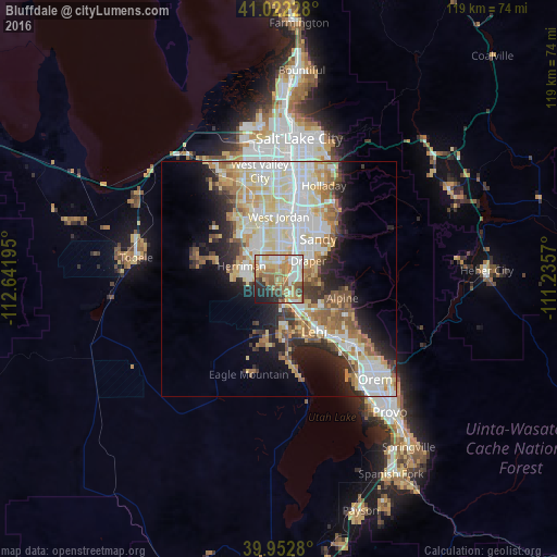
Analysis of Bluffdale night lights 2016
Square area 10x10 km:
 13.78%
90-99
12.24%80-89
11.73%70-79
12.59%60-69
16.67%50-59
10.37%40-49
4.59%30-39
4.25%20-29
9.86%10-19
3.91%0-9
0%Square area 50x50 km:
7.71%90-99
8.26%80-89
5.88%70-79
4.14%60-69
4.14%50-59
4.19%40-49
2.42%30-39
2.81%20-29
5.91%10-19
8.46%0-9
46.07%Clear (daylight) street map image can be seen on geolist.org.
Map coordinates:
41° 1' 20.2" North, 112° 38' 31" West
40° 29' 22.8" North, 111° 56' 19.8" West
39° 57' 10.1" North, 111° 14' 8.5" West
Some cities around Bluffdale sort by population:
• Sandy Hills
12.6 km =7.8 mi,  36°
36°
• Sandy
12.2 km =7.6 mi,  22°
22°
• South Jordan
8.1 km =5 mi,  5°
5°
• Draper
7.4 km =4.6 mi,  58°
58°
• Riverton
3.6 km =2.2 mi,  359°
359°
• South Jordan Heights
8.3 km =5.2 mi,  353°
353°
• Herriman
8.4 km =5.2 mi,  288°
288°
• White City
10.5 km =6.5 mi, 36°
5771716 (p: 10,931)
Sources (retrieved 2019-11-25):
» Earth at Night: Flat Maps 2012, 2016