South Gate night lights from space
Night Light of South Gate (Maryland) from space (United States) Src. Average luminocity for 10x10km area is 81.4659% and for 50x50km: 63.1735%.
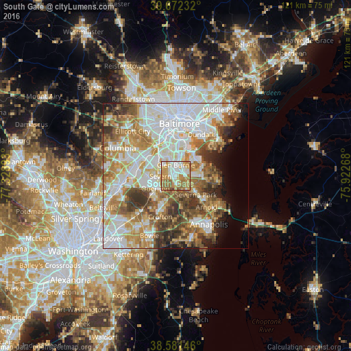
Analysis of South Gate night lights 2016
Square area 10x10 km:
 18.34%
90-99
21.92%80-89
9.74%70-79
23.54%60-69
19.16%50-59
6.49%40-49
0.81%30-39
0%20-29
0%10-19
0%0-9
0%Square area 50x50 km:
19.11%90-99
14.48%80-89
7.2%70-79
9.74%60-69
8.77%50-59
8.49%40-49
5.9%30-39
5.75%20-29
4.01%10-19
3.92%0-9
12.64%Clear (daylight) street map image can be seen on geolist.org.
Map coordinates:
39° 40' 20.4" North, 77° 19' 44.1" West
39° 7' 44.4" North, 76° 37' 32.9" West
38° 34' 53.3" North, 75° 55' 21.6" West
Some cities around South Gate sort by population:
• Glen Burnie
3.7 km =2.3 mi,  1°
1°
• Severn
6.3 km =3.9 mi,  278°
278°
• Severna Park
9.5 km =5.9 mi,  133°
133°
• Odenton
8.1 km =5 mi,  232°
232°
• Pasadena
5.3 km =3.3 mi,  117°
117°
• Green Haven
6.8 km =4.2 mi,  80°
80°
• Ferndale
6.1 km =3.8 mi,  348°
348°
• Linthicum
8.8 km =5.5 mi,  344°
344°
4369964 (p: 29,658)
Sources (retrieved 2019-11-25):
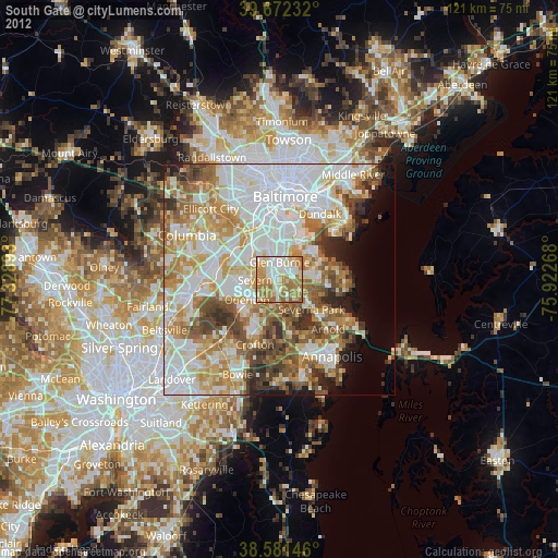
» Earth at Night: Flat Maps 2012, 2016