Somerset night lights from space
Night Light of Somerset (Massachusetts) from space (United States) Src. Average luminocity for 10x10km area is 40.6006% and for 50x50km: 33.3567%.
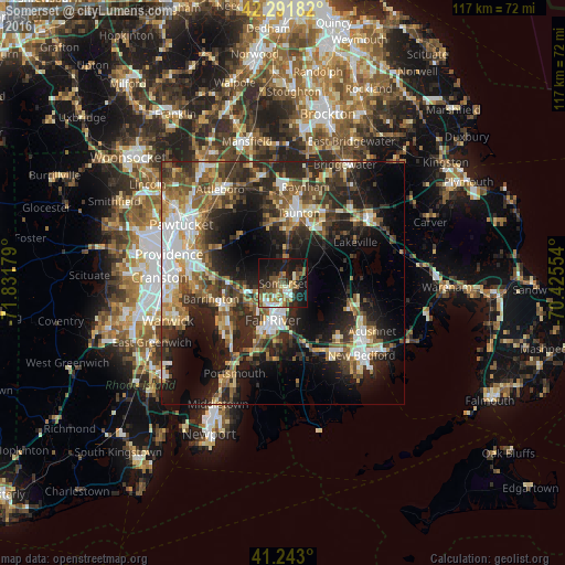
Analysis of Somerset night lights 2016
Square area 10x10 km:
 5.03%
5.03%90-99
6.82%80-89
3.08%70-79
4.06%60-69
6.49%50-59
11.85%40-49
6.66%30-39
3.73%20-29
13.8%10-19
33.6%0-9
4.87%Square area 50x50 km:
5.11%90-99
5.52%80-89
3.7%70-79
3.43%60-69
4.64%50-59
5.74%40-49
5.71%30-39
6.48%20-29
11.86%10-19
17.21%0-9
30.6%Clear (daylight) street map image can be seen on geolist.org.
Map coordinates:
42° 17' 30.6" North, 71° 49' 54.4" West
41° 46' 10.4" North, 71° 7' 43.2" West
41° 14' 34.8" North, 70° 25' 31.9" West
Some cities around Somerset sort by population:
• Fall River
7.9 km =4.9 mi,  196°
196°
• Taunton
14.9 km =9.3 mi,  12°
12°
• Swansea
5.6 km =3.5 mi,  244°
244°
• Rehoboth
12.7 km =7.9 mi,  308°
308°
• Warren
13.5 km =8.4 mi,  251°
251°
• Freetown
8 km =5 mi,  92°
92°
• Dighton
5 km =3.1 mi, 7°
• Berkley
9.3 km =5.8 mi,  24°
24°
4951248 (p: 18,165)
Sources (retrieved 2019-11-25):
» Earth at Night: Flat Maps 2012, 2016