Berkley night lights from space
Night Light of Berkley (Massachusetts) from space (United States) Src. Average luminocity for 10x10km area is 33.846% and for 50x50km: 34.1904%.
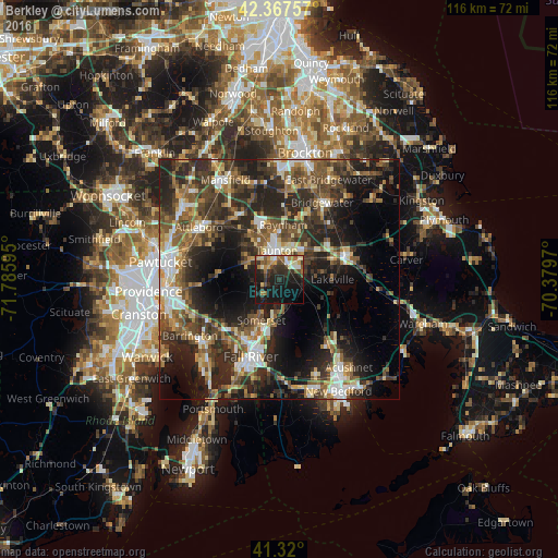
Analysis of Berkley night lights 2016
Square area 10x10 km:
 2.06%
2.06%90-99
5.87%80-89
3.49%70-79
3.81%60-69
5.87%50-59
4.92%40-49
4.29%30-39
9.05%20-29
15.56%10-19
33.49%0-9
11.59%Square area 50x50 km:
3.9%90-99
4.95%80-89
3.8%70-79
3.46%60-69
5.02%50-59
6.91%40-49
7.62%30-39
8.24%20-29
14.01%10-19
15.52%0-9
26.57%Clear (daylight) street map image can be seen on geolist.org.
Map coordinates:
42° 22' 3.3" North, 71° 47' 9.4" West
41° 50' 45.3" North, 71° 4' 58.2" West
41° 19' 12" North, 70° 22' 46.9" West
Some cities around Berkley sort by population:
• Taunton
6.1 km =3.8 mi,  354°
354°
• Somerset
9.3 km =5.8 mi,  204°
204°
• Swansea
14 km =8.7 mi,  219°
219°
• Raynham
11.5 km =7.1 mi,  4°
4°
• Rehoboth
13.8 km =8.6 mi,  267°
267°
• Freetown
9.7 km =6 mi,  154°
154°
• Middleborough Center
14.1 km =8.8 mi,  67°
67°
• Dighton
4.7 km =2.9 mi, 221°
4930385 (p: 5,849)
Sources (retrieved 2019-11-25):
» Earth at Night: Flat Maps 2012, 2016