Freetown night lights from space
Night Light of Freetown (Massachusetts) from space (United States) Src. Average luminocity for 10x10km area is 6.8344% and for 50x50km: 25.5109%.
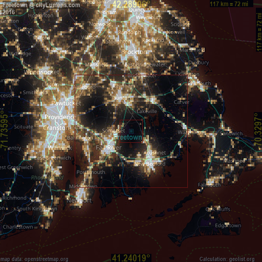
Analysis of Freetown night lights 2016
Square area 10x10 km:
 0%
0%90-99
0%80-89
0%70-79
0%60-69
0.65%50-59
2.11%40-49
0.32%30-39
0.65%20-29
2.76%10-19
14.29%0-9
79.22%Square area 50x50 km:
2.5%90-99
3.49%80-89
2.93%70-79
2.5%60-69
3.47%50-59
4.64%40-49
5.07%30-39
6%20-29
10.98%10-19
16.65%0-9
41.78%Clear (daylight) street map image can be seen on geolist.org.
Map coordinates:
42° 17' 20.6" North, 71° 44' 9.4" West
41° 46' 0.4" North, 71° 1' 58.2" West
41° 14' 24.7" North, 70° 19' 46.9" West
Some cities around Freetown sort by population:
• Fall River
12.5 km =7.8 mi,  234°
234°
• Taunton
15.6 km =9.7 mi,  342°
342°
• Somerset
8 km =5 mi,  272°
272°
• Swansea
13.2 km =8.2 mi,  260°
260°
• Head of Westport
16.4 km =10.2 mi,  188°
188°
• Acushnet
14.1 km =8.8 mi,  132°
132°
• Dighton
9 km =5.6 mi,  305°
305°
• Berkley
9.7 km =6 mi,  334°
334°
4937355 (p: 8,472)
Sources (retrieved 2019-11-25):
» Earth at Night: Flat Maps 2012, 2016