Warren night lights from space
Night Light of Warren (Rhode Island) from space (United States) Src. Average luminocity for 10x10km area is 46.3766% and for 50x50km: 39.1019%.
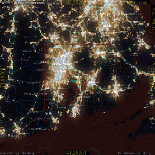
Analysis of Warren night lights 2016
Square area 10x10 km:
 1.79%
1.79%90-99
6.49%80-89
4.38%70-79
5.52%60-69
9.9%50-59
9.25%40-49
18.18%30-39
12.01%20-29
22.24%10-19
10.23%0-9
0%Square area 50x50 km:
7.42%90-99
6.86%80-89
4.17%70-79
4.6%60-69
5.99%50-59
7.16%40-49
5.72%30-39
6.28%20-29
10.01%10-19
16.51%0-9
25.3%Clear (daylight) street map image can be seen on geolist.org.
Map coordinates:
42° 15' 10.7" North, 71° 59' 8.4" West
41° 43' 49.4" North, 71° 16' 57.2" West
41° 12' 12.6" North, 70° 34' 45.9" West
Some cities around Warren sort by population:
• Fall River
11.1 km =6.9 mi,  106°
106°
• Warwick
11.6 km =7.2 mi,  253°
253°
• East Providence
11.8 km =7.3 mi,  321°
321°
• Bristol
6.1 km =3.8 mi,  167°
167°
• Barrington
2.4 km =1.5 mi,  297°
297°
• Swansea
7.9 km =4.9 mi,  75°
75°
• Seekonk
9.8 km =6.1 mi,  332°
332°
• Rehoboth
12.5 km =7.8 mi,  12°
12°
5225502 (p: 11,280)
Sources (retrieved 2019-11-25):
» Earth at Night: Flat Maps 2012, 2016