Solana Beach night lights from space
Night Light of Solana Beach (California) from space (United States) Src. Average luminocity for 10x10km area is 38.511% and for 50x50km: 34.6322%.
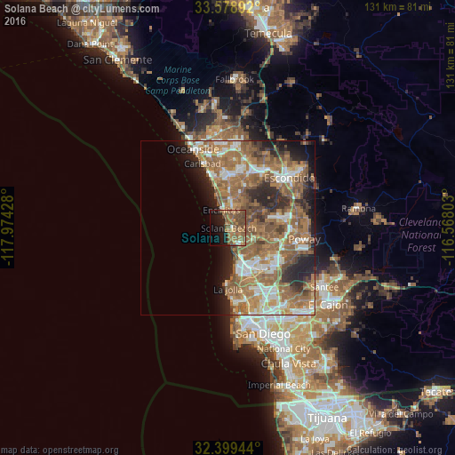
Analysis of Solana Beach night lights 2016
Square area 10x10 km:
 0.73%
0.73%90-99
1.47%80-89
0.55%70-79
4.95%60-69
18.5%50-59
14.84%40-49
15.75%30-39
0.18%20-29
6.23%10-19
19.96%0-9
16.85%Square area 50x50 km:
4.98%90-99
4.99%80-89
2.02%70-79
3.91%60-69
12.95%50-59
10.45%40-49
5.24%30-39
2.91%20-29
6.46%10-19
6.59%0-9
39.51%Clear (daylight) street map image can be seen on geolist.org.
Map coordinates:
33° 34' 44.1" North, 117° 58' 27.4" West
32° 59' 28.1" North, 117° 16' 16.1" West
32° 23' 58" North, 116° 34' 4.9" West
Some cities around Solana Beach sort by population:
• Escondido
22.3 km =13.9 mi,  50°
50°
• Carlsbad
20 km =12.4 mi,  338°
338°
• San Marcos
19.6 km =12.2 mi,  30°
30°
• Mira Mesa
14.5 km =9 mi,  125°
125°
• Encinitas
5.5 km =3.4 mi, 339°
• Rancho Penasquitos
15 km =9.3 mi,  103°
103°
• Poway
22.2 km =13.8 mi, 98°
• La Jolla
16 km =9.9 mi,  181°
181°
5396974 (p: 13,449)
Sources (retrieved 2019-11-25):
» Earth at Night: Flat Maps 2012, 2016