Encinitas night lights from space
Night Light of Encinitas (California) from space (United States) Src. Average luminocity for 10x10km area is 38.9744% and for 50x50km: 32.3567%.
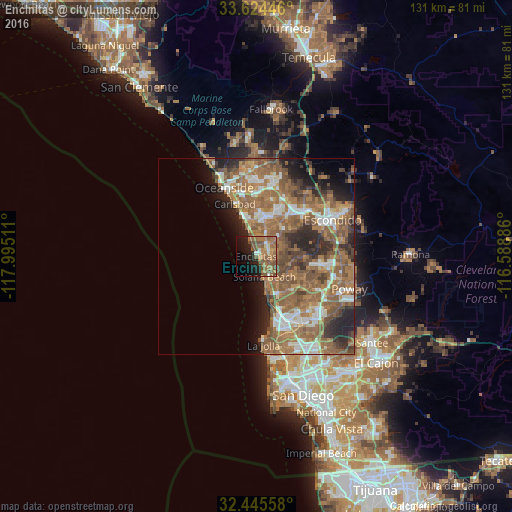
Analysis of Encinitas night lights 2016
Square area 10x10 km:
 1.83%
1.83%90-99
2.56%80-89
2.56%70-79
5.31%60-69
16.48%50-59
15.2%40-49
8.97%30-39
0.18%20-29
7.69%10-19
20.15%0-9
19.05%Square area 50x50 km:
4.34%90-99
4.28%80-89
1.79%70-79
2.94%60-69
12.2%50-59
10.84%40-49
5.55%30-39
3.27%20-29
6.41%10-19
6.15%0-9
42.23%Clear (daylight) street map image can be seen on geolist.org.
Map coordinates:
33° 37' 28.1" North, 117° 59' 42.4" West
33° 2' 13.2" North, 117° 17' 31.1" West
32° 26' 44.1" North, 116° 35' 19.9" West
Some cities around Encinitas sort by population:
• Oceanside
19.5 km =12.1 mi,  335°
335°
• Escondido
21.2 km =13.2 mi,  64°
64°
• Carlsbad
14.5 km =9 mi, 337°
• Vista
18.7 km =11.6 mi,  14°
14°
• San Marcos
16.7 km =10.4 mi,  44°
44°
• Mira Mesa
19.3 km =12 mi,  134°
134°
• Rancho Penasquitos
18.6 km =11.6 mi,  117°
117°
• Solana Beach
5.5 km =3.4 mi,  159°
159°
5346646 (p: 62,930)
Sources (retrieved 2019-11-25):
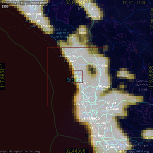
» NASA, Earths city lights 1995
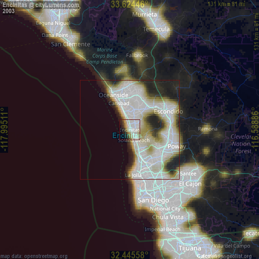
» NASA city lights 2003
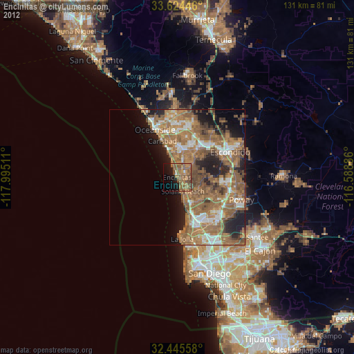
» Earth at Night: Flat Maps 2012, 2016