Poway night lights from space
Night Light of Poway (California) from space (United States) Src. Average luminocity for 10x10km area is 52.2033% and for 50x50km: 41.2708%.
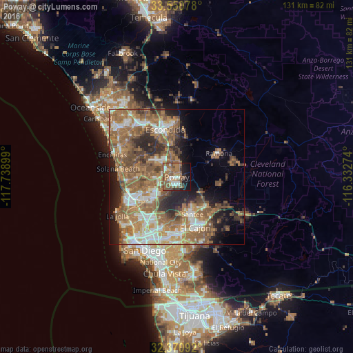
Analysis of Poway night lights 2016
Square area 10x10 km:
 5.13%
5.13%90-99
9.52%80-89
1.83%70-79
3.3%60-69
22.34%50-59
19.78%40-49
7.33%30-39
2.56%20-29
4.76%10-19
20.33%0-9
3.11%Square area 50x50 km:
6.18%90-99
6.12%80-89
2.95%70-79
4.59%60-69
14.25%50-59
11.52%40-49
6.66%30-39
3.81%20-29
6.72%10-19
8%0-9
29.21%Clear (daylight) street map image can be seen on geolist.org.
Map coordinates:
33° 33' 2.8" North, 117° 44' 20.4" West
32° 57' 46.2" North, 117° 2' 9.1" West
32° 22' 15.3" North, 116° 19' 57.9" West
Some cities around Poway sort by population:
• Escondido
18 km =11.2 mi,  344°
344°
• Mira Mesa
11.4 km =7.1 mi,  242°
242°
• Rancho Penasquitos
7.4 km =4.6 mi,  267°
267°
• Santee
15 km =9.3 mi,  157°
157°
• Lakeside
15.8 km =9.8 mi,  137°
137°
• Winter Gardens
17.5 km =10.9 mi,  146°
146°
• Ramona
17.9 km =11.1 mi,  60°
60°
• Eucalyptus Hills
12.4 km =7.7 mi, 137°
5384690 (p: 50,157)
Sources (retrieved 2019-11-25):
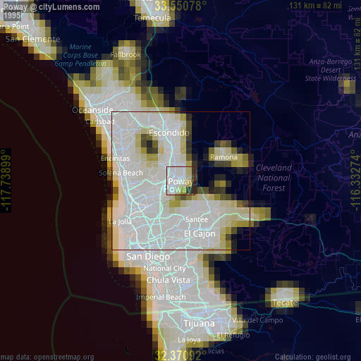
» NASA, Earths city lights 1995
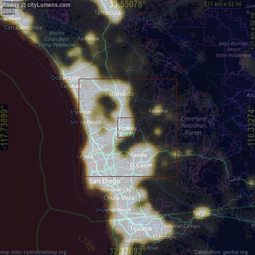
» NASA city lights 2003
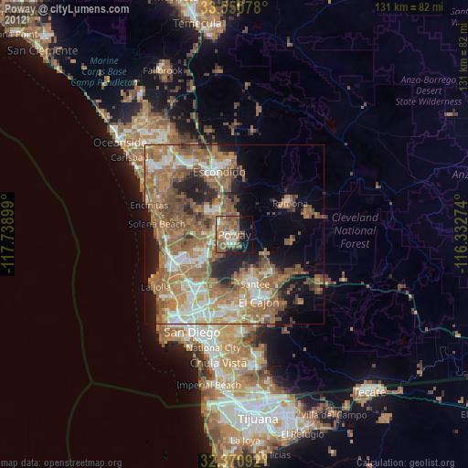
» Earth at Night: Flat Maps 2012, 2016