Shenandoah night lights from space
Night Light of Shenandoah (Iowa) from space (United States) Src. Average luminocity for 10x10km area is 8.1429% and for 50x50km: 0.7052%.
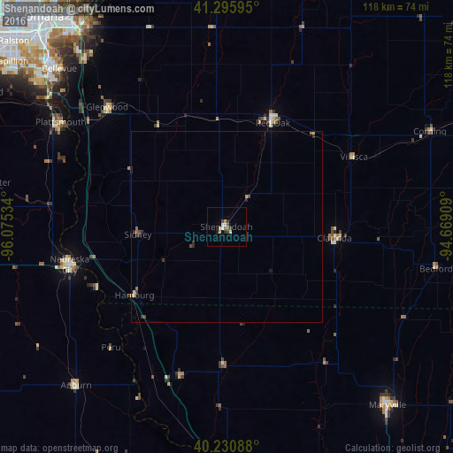
Analysis of Shenandoah night lights 2016
Square area 10x10 km:
 1.3%
1.3%90-99
1.14%80-89
1.95%70-79
0.16%60-69
0%50-59
1.3%40-49
2.27%30-39
1.3%20-29
0.65%10-19
0.32%0-9
89.61%Square area 50x50 km:
0.05%90-99
0.07%80-89
0.12%70-79
0.07%60-69
0.05%50-59
0.09%40-49
0.2%30-39
0.22%20-29
0.17%10-19
0.07%0-9
98.89%Clear (daylight) street map image can be seen on geolist.org.
Map coordinates:
41° 17' 45.4" North, 96° 4' 31.2" West
40° 45' 56" North, 95° 22' 20" West
40° 13' 51.2" North, 94° 40' 8.7" West
Some cities around Shenandoah sort by population:
• Council Bluffs
68.8 km =42.8 mi,  323°
323°
• Bellevue
60 km =37.3 mi,  313°
313°
• Maryville
62.9 km =39.1 mi,  137°
137°
• Nebraska City
42.2 km =26.2 mi,  256°
256°
• Plattsmouth
50.8 km =31.6 mi,  302°
302°
• Red Oak
29.8 km =18.5 mi,  24°
24°
• Clarinda
28.3 km =17.6 mi,  95°
95°
• Glenwood
44.1 km =27.4 mi, 315°
4876190 (p: 5,021)
Sources (retrieved 2019-11-25):
» Earth at Night: Flat Maps 2012, 2016