Glenwood night lights from space
Night Light of Glenwood (Iowa) from space (United States) Src. Average luminocity for 10x10km area is 9.852% and for 50x50km: 13.3969%.
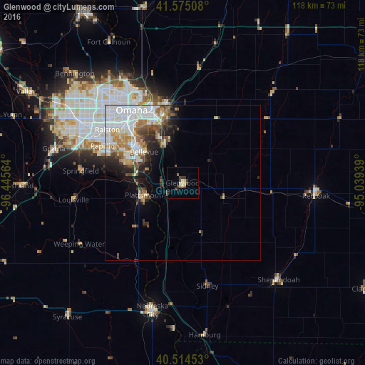
Analysis of Glenwood night lights 2016
Square area 10x10 km:
 0%
0%90-99
1.87%80-89
1.19%70-79
1.87%60-69
1.53%50-59
0.51%40-49
2.38%30-39
2.72%20-29
0.51%10-19
0.34%0-9
87.07%Square area 50x50 km:
4.36%90-99
2.67%80-89
0.97%70-79
1.3%60-69
1.98%50-59
1.33%40-49
1.57%30-39
1.54%20-29
2.06%10-19
3.2%0-9
79.03%Clear (daylight) street map image can be seen on geolist.org.
Map coordinates:
41° 34' 30.3" North, 96° 26' 44.3" West
41° 2' 49" North, 95° 44' 33" West
40° 30' 52.3" North, 95° 2' 21.8" West
Some cities around Glenwood sort by population:
• Omaha
28.6 km =17.8 mi,  324°
324°
• Council Bluffs
25.9 km =16.1 mi,  337°
337°
• Bellevue
15.9 km =9.9 mi,  308°
308°
• Papillion
27.8 km =17.3 mi,  295°
295°
• La Vista
28.6 km =17.8 mi, 302°
• Chalco
37.4 km =23.2 mi,  294°
294°
• Plattsmouth
12.4 km =7.7 mi,  251°
251°
• Ralston
30.7 km =19.1 mi, 305°
4858479 (p: 5,253)
Sources (retrieved 2019-11-25):
» Earth at Night: Flat Maps 2012, 2016