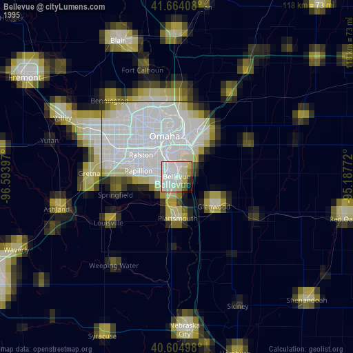
Bellevue night lights from space
Night Light of Bellevue (Nebraska) from space (United States) Src. Average luminocity for 10x10km area is 49.6266% and for 50x50km: 29.6867%.
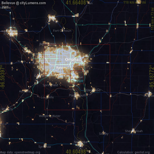
Analysis of Bellevue night lights 2016
Square area 10x10 km:
 10.88%
90-99
10.71%80-89
3.9%70-79
6.66%60-69
7.79%50-59
5.36%40-49
8.12%30-39
6.33%20-29
15.1%10-19
17.37%0-9
7.79%Square area 50x50 km:
10.06%90-99
7.86%80-89
2.8%70-79
2.28%60-69
3.18%50-59
2.6%40-49
2.51%30-39
2.72%20-29
4.15%10-19
5.34%0-9
56.51%Clear (daylight) street map image can be seen on geolist.org.
Map coordinates:
41° 39' 50.7" North, 96° 35' 38.3" West
41° 8' 12" North, 95° 53' 27" West
40° 36' 17.9" North, 95° 11' 15.8" West
Some cities around Bellevue sort by population:
• Omaha
13.9 km =8.6 mi,  342°
342°
• Council Bluffs
14.2 km =8.8 mi,  10°
10°
• Papillion
12.8 km =8 mi,  278°
278°
• La Vista
12.9 km =8 mi,  294°
294°
• Chalco
22.3 km =13.9 mi, 283°
• Plattsmouth
13.9 km =8.6 mi,  177°
177°
• Ralston
14.8 km =9.2 mi,  301°
301°
• Glenwood
15.9 km =9.9 mi,  128°
128°
5063805 (p: 55,510)
Sources (retrieved 2019-11-25):
» NASA, Earths city lights 1995
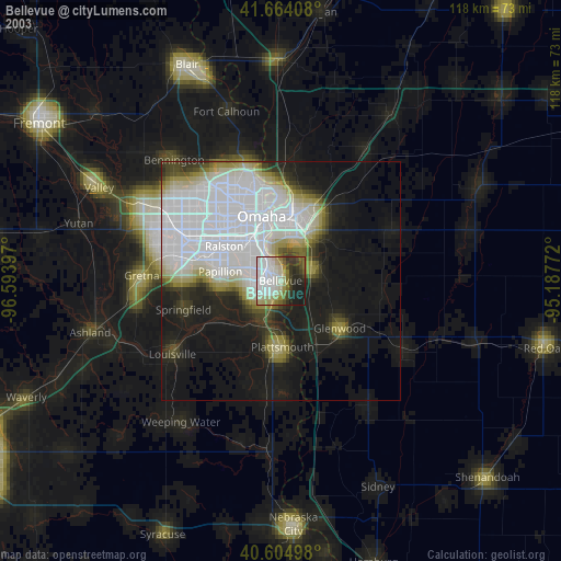
» NASA city lights 2003
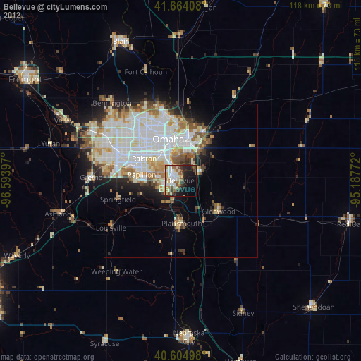
» Earth at Night: Flat Maps 2012, 2016