Sharon night lights from space
Night Light of Sharon (Pennsylvania) from space (United States) Src. Average luminocity for 10x10km area is 59.5698% and for 50x50km: 23.3926%.
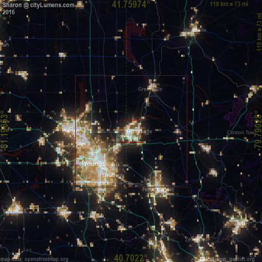
Analysis of Sharon night lights 2016
Square area 10x10 km:
 9.25%
9.25%90-99
14.61%80-89
9.09%70-79
5.19%60-69
10.88%50-59
9.74%40-49
11.36%30-39
6.82%20-29
16.23%10-19
6.66%0-9
0.16%Square area 50x50 km:
3.22%90-99
4.26%80-89
3.05%70-79
3.61%60-69
4.32%50-59
3.91%40-49
3.56%30-39
3.22%20-29
5.27%10-19
7.32%0-9
58.28%Clear (daylight) street map image can be seen on geolist.org.
Map coordinates:
41° 45' 35.1" North, 81° 11' 47.5" West
41° 13' 59.2" North, 80° 29' 36.2" West
40° 42' 7.9" North, 79° 47' 25" West
Some cities around Sharon sort by population:
• Youngstown
19.8 km =12.3 mi,  221°
221°
• Hermitage
3.7 km =2.3 mi,  89°
89°
• Struthers
22.2 km =13.8 mi,  205°
205°
• Girard
19.5 km =12.1 mi,  243°
243°
• Campbell
19.4 km =12.1 mi, 207°
• Hubbard
10.6 km =6.6 mi, 216°
• Howland Center
21.2 km =13.2 mi,  275°
275°
• Greenville
20.9 km =13 mi,  24°
24°
5211683 (p: 13,562)
Sources (retrieved 2019-11-25):
» Earth at Night: Flat Maps 2012, 2016