Howland Center night lights from space
Night Light of Howland Center (Ohio) from space (United States) Src. Average luminocity for 10x10km area is 63.6558% and for 50x50km: 24.6028%.
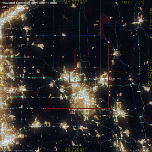
Analysis of Howland Center night lights 2016
Square area 10x10 km:
 14.45%
90-99
14.45%80-89
6.17%70-79
7.31%60-69
9.25%50-59
15.26%40-49
7.14%30-39
9.9%20-29
11.36%10-19
4.71%0-9
0%Square area 50x50 km:
3.47%90-99
4.66%80-89
2.92%70-79
3.61%60-69
4.16%50-59
4.25%40-49
3.44%30-39
3.77%20-29
6.76%10-19
8.69%0-9
54.28%Clear (daylight) street map image can be seen on geolist.org.
Map coordinates:
41° 46' 39.6" North, 81° 26' 54.6" West
41° 15' 4.2" North, 80° 44' 43.3" West
40° 43' 13.5" North, 80° 2' 32.1" West
Some cities around Howland Center sort by population:
• Youngstown
18.6 km =11.6 mi,  154°
154°
• Warren
6.3 km =3.9 mi,  256°
256°
• Austintown
16.7 km =10.4 mi,  185°
185°
• Niles
7.8 km =4.8 mi, 192°
• Girard
11.4 km =7.1 mi,  161°
161°
• Hubbard
18.1 km =11.2 mi,  125°
125°
• Cortland
9 km =5.6 mi,  10°
10°
• Champion Heights
9.4 km =5.8 mi,  297°
297°
5158123 (p: 6,351)
Sources (retrieved 2019-11-25):
» Earth at Night: Flat Maps 2012, 2016