Struthers night lights from space
Night Light of Struthers (Ohio) from space (United States) Src. Average luminocity for 10x10km area is 74.7721% and for 50x50km: 32.5863%.
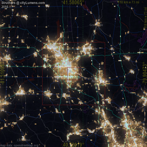
Analysis of Struthers night lights 2016
Square area 10x10 km:
 15.48%
90-99
17.69%80-89
18.03%70-79
13.61%60-69
9.69%50-59
9.69%40-49
4.76%30-39
5.44%20-29
5.27%10-19
0.34%0-9
0%Square area 50x50 km:
4.1%90-99
6.01%80-89
4.06%70-79
4.38%60-69
5.61%50-59
5.56%40-49
4.64%30-39
4.88%20-29
9.23%10-19
14.61%0-9
36.92%Clear (daylight) street map image can be seen on geolist.org.
Map coordinates:
41° 34' 50.3" North, 81° 18' 39.5" West
41° 3' 9.2" North, 80° 36' 28.3" West
40° 31' 12.7" North, 79° 54' 17" West
Some cities around Struthers sort by population:
• Youngstown
6.3 km =3.9 mi,  326°
326°
• Boardman
5.6 km =3.5 mi,  235°
235°
• Austintown
14.2 km =8.8 mi,  292°
292°
• Girard
13.7 km =8.5 mi, 325°
• Campbell
3 km =1.9 mi,  14°
14°
• Hubbard
12 km =7.5 mi,  15°
15°
• Canfield
13.2 km =8.2 mi,  256°
256°
• Columbiana
19.6 km =12.2 mi,  201°
201°
5173256 (p: 10,375)
Sources (retrieved 2019-11-25):
» Earth at Night: Flat Maps 2012, 2016