Sellersburg night lights from space
Night Light of Sellersburg (Indiana) from space (United States) Src. Average luminocity for 10x10km area is 50.4898% and for 50x50km: 32.0495%.
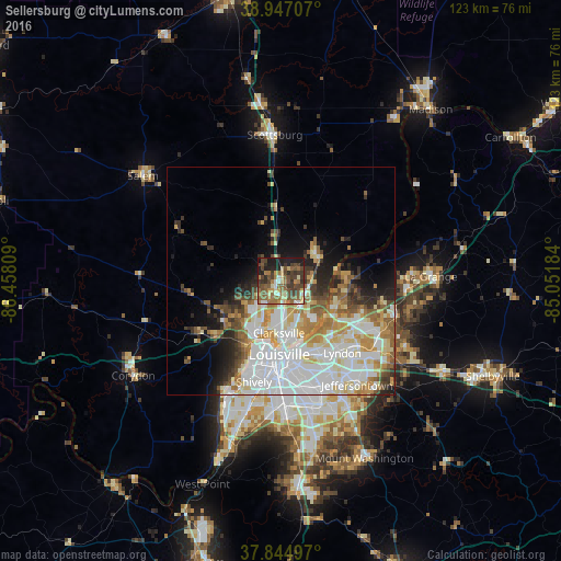
Analysis of Sellersburg night lights 2016
Square area 10x10 km:
 2.89%
2.89%90-99
4.76%80-89
8.33%70-79
4.42%60-69
13.27%50-59
14.63%40-49
17.18%30-39
12.93%20-29
8.16%10-19
12.93%0-9
0.51%Square area 50x50 km:
9.69%90-99
7.32%80-89
3.94%70-79
3.48%60-69
4.19%50-59
3.4%40-49
3.12%30-39
3%20-29
3.71%10-19
6.06%0-9
52.09%Clear (daylight) street map image can be seen on geolist.org.
Map coordinates:
38° 56' 49.5" North, 86° 27' 29.1" West
38° 23' 53.2" North, 85° 45' 17.9" West
37° 50' 41.9" North, 85° 3' 6.6" West
Some cities around Sellersburg sort by population:
• Louisville
16 km =9.9 mi,  181°
181°
• Jeffersonville
13.5 km =8.4 mi,  173°
173°
• New Albany
13.9 km =8.6 mi,  205°
205°
• Clarksville
11.3 km =7 mi, 182°
• Saint Matthews
18.3 km =11.4 mi,  151°
151°
• Lyndon
20.6 km =12.8 mi,  139°
139°
• Charlestown
9.6 km =6 mi,  50°
50°
• Oak Park
11.5 km =7.1 mi, 153°
4264598 (p: 8,659)
Sources (retrieved 2019-11-25):
» Earth at Night: Flat Maps 2012, 2016