Lyndon night lights from space
Night Light of Lyndon (Kentucky) from space (United States) Src. Average luminocity for 10x10km area is 92.6531% and for 50x50km: 48.3784%.
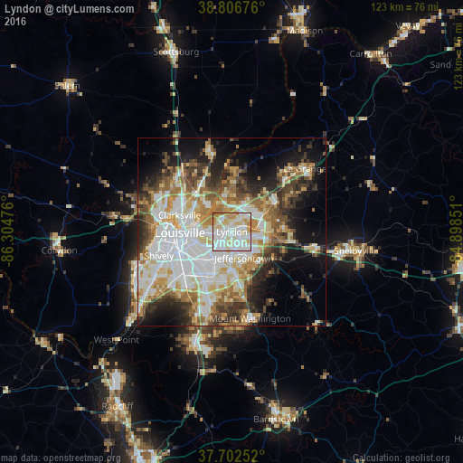
Analysis of Lyndon night lights 2016
Square area 10x10 km:
 34.52%
90-99
35.03%80-89
17.18%70-79
9.69%60-69
3.57%50-59
0%40-49
0%30-39
0%20-29
0%10-19
0%0-9
0%Square area 50x50 km:
12.7%90-99
11.01%80-89
6.41%70-79
5.89%60-69
6.22%50-59
5.21%40-49
5.36%30-39
5.89%20-29
6.87%10-19
10.91%0-9
23.51%Clear (daylight) street map image can be seen on geolist.org.
Map coordinates:
38° 48' 24.3" North, 86° 18' 17.1" West
38° 15' 24.3" North, 85° 36' 5.9" West
37° 42' 9.1" North, 84° 53' 54.6" West
Some cities around Lyndon sort by population:
• Jeffersontown
7.7 km =4.8 mi,  154°
154°
• Newburg
11.9 km =7.4 mi,  205°
205°
• Fern Creek
10.8 km =6.7 mi,  173°
173°
• Saint Matthews
4.7 km =2.9 mi,  264°
264°
• Middletown
5.6 km =3.5 mi,  103°
103°
• Buechel
8.1 km =5 mi, 212°
• Douglass Hills
4.8 km =3 mi,  116°
116°
• Oak Park
9.9 km =6.2 mi,  303°
303°
4299562 (p: 11,372)
Sources (retrieved 2019-11-25):
» Earth at Night: Flat Maps 2012, 2016