Jeffersonville night lights from space
Night Light of Jeffersonville (Indiana) from space (United States) Src. Average luminocity for 10x10km area is 92.2313% and for 50x50km: 45.4917%.
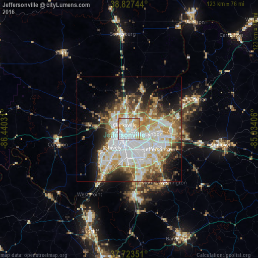
Analysis of Jeffersonville night lights 2016
Square area 10x10 km:
 34.52%
90-99
34.52%80-89
11.9%70-79
14.46%60-69
4.59%50-59
0%40-49
0%30-39
0%20-29
0%10-19
0%0-9
0%Square area 50x50 km:
12.63%90-99
10.71%80-89
6.07%70-79
5.35%60-69
5.65%50-59
4.83%40-49
4.65%30-39
4.61%20-29
6.41%10-19
8.76%0-9
30.32%Clear (daylight) street map image can be seen on geolist.org.
Map coordinates:
38° 49' 38.8" North, 86° 26' 25.1" West
38° 16' 39.3" North, 85° 44' 13.8" West
37° 43' 24.6" North, 85° 2' 2.6" West
Some cities around Jeffersonville sort by population:
• Louisville
3.2 km =2 mi,  216°
216°
• New Albany
7.6 km =4.7 mi,  276°
276°
• Clarksville
2.9 km =1.8 mi,  316°
316°
• Saint Matthews
7.6 km =4.7 mi,  111°
111°
• Shively
11.4 km =7.1 mi, 220°
• Lyndon
12.1 km =7.5 mi,  101°
101°
• Buechel
11.8 km =7.3 mi,  140°
140°
• Oak Park
4.7 km =2.9 mi,  48°
48°
4259671 (p: 46,960)
Sources (retrieved 2019-11-25):
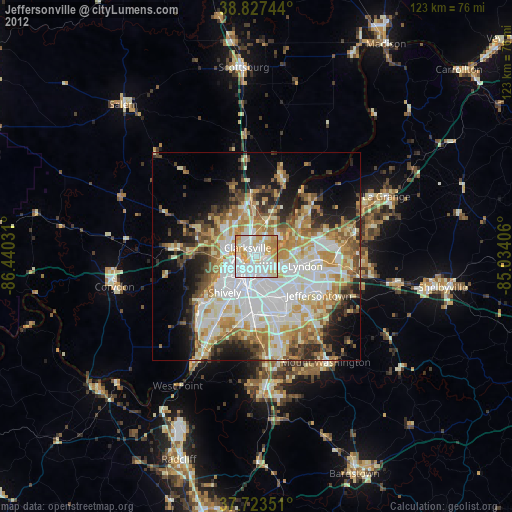
» Earth at Night: Flat Maps 2012, 2016