Santa Cruz night lights from space
Night Light of Santa Cruz (California) from space (United States) Src. Average luminocity for 10x10km area is 36.1445% and for 50x50km: 4.9363%.
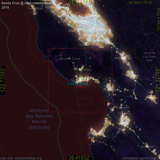
Analysis of Santa Cruz night lights 2016
Square area 10x10 km:
 3.57%
3.57%90-99
5.36%80-89
2.92%70-79
7.47%60-69
6.66%50-59
3.25%40-49
8.44%30-39
4.22%20-29
10.06%10-19
31.66%0-9
16.4%Square area 50x50 km:
0.36%90-99
0.63%80-89
0.26%70-79
0.77%60-69
0.82%50-59
0.59%40-49
0.78%30-39
0.88%20-29
0.69%10-19
5.7%0-9
88.52%Clear (daylight) street map image can be seen on geolist.org.
Map coordinates:
37° 32' 1.6" North, 122° 44' 2.1" West
36° 58' 26.8" North, 122° 1' 50.9" West
36° 24' 37.2" North, 121° 19' 39.6" West
Some cities around Santa Cruz sort by population:
• Watsonville
25.4 km =15.8 mi,  106°
106°
• Live Oak
4.6 km =2.9 mi,  76°
76°
• Scotts Valley
8.7 km =5.4 mi,  9°
9°
• Capitola
6.9 km =4.3 mi,  88°
88°
• Soquel
6.8 km =4.2 mi, 76°
• Rio Del Mar
11.6 km =7.2 mi, 93°
• Ben Lomond
13.7 km =8.5 mi,  338°
338°
• Aptos
11.7 km =7.3 mi, 88°
5393052 (p: 64,220)
Sources (retrieved 2019-11-25):
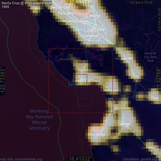
» NASA, Earths city lights 1995
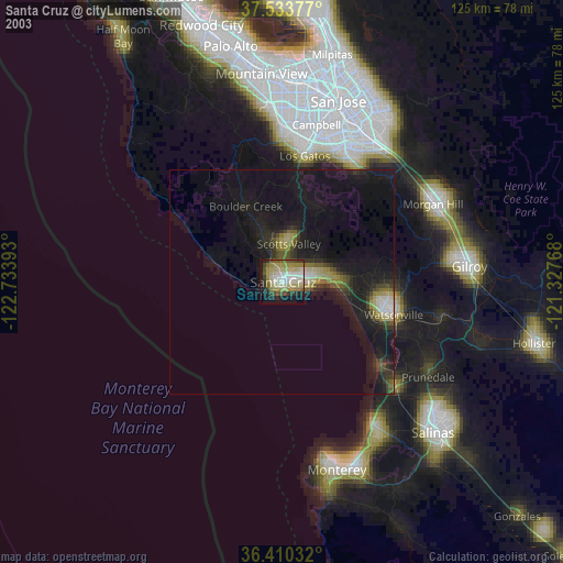
» NASA city lights 2003
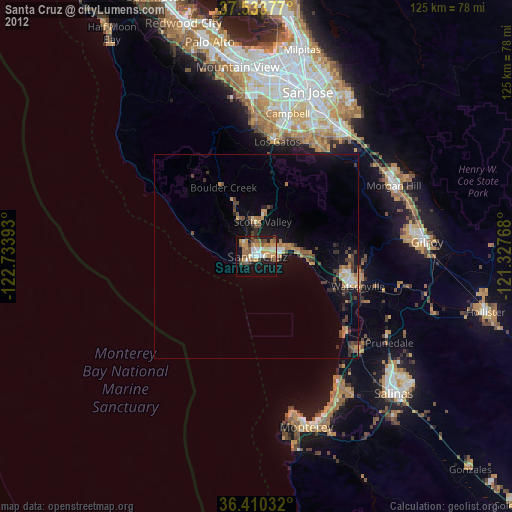
» Earth at Night: Flat Maps 2012, 2016